Bowes Castle and Mill Force Walk
If you're looking for a short walk that helps you slow down for half an hour, this is a lovely choice.
Starting in the centre of Bowes, the route takes you past the ruins of Bowes Castle, across open countryside and down through woodland beside the River Greta before reaching Mill Force waterfall. Along the way you'll pass through a landscape shaped by Roman soldiers, Norman builders and generations of local people who lived and worked beside the river.
What makes this walk so enjoyable is its simplicity. The castle stands quietly above the village, the river winds through the trees below, and around Mill Force there are still small reminders of the old corn mill that once stood beside the waterfall.
It's not a long walk, and it doesn't need to be. This is simply a peaceful way to spend some time outdoors while discovering a little of Bowes' history and landscape.
Quick Facts
Location: Bowes, County Durham
Postcode: DL12 9HR
Walk Type: Circular walk
Distance: 1.3 miles / 2.1 km
Time: 30–45 minutes
Difficulty: Easy
Terrain: Village lanes, grassy paths, woodland tracks and uneven riverside sections
Dogs: Yes, on leads near livestock and roads
Parking: Free parking opposite Bowes & Gilmonby Village Hall
Map: OS Explorer OL31 – North Pennines
Digital Route: Hiiker route available
GPX File: Free GPX download available

Parking and Access
Free parking is available opposite Bowes & Gilmonby Village Hall, making this one of the easiest short walks to start in the area.
Most of the route is straightforward and suitable for families, although the woodland section beside the River Greta can become muddy after rain. There are exposed tree roots, uneven ground and some steeper sections as the path drops towards Mill Force.
Good footwear is recommended throughout the year, especially during winter.
Bowes Castle itself is managed by English Heritage and is free to explore during daylight hours.

The Walk Route
Begin from the free parking area opposite Bowes & Gilmonby Village Hall and walk uphill through the centre of Bowes village.
It is hard to imagine now, but this peaceful village once stood on an important route across the Pennines.
As you continue uphill, you'll pass St Giles Church on your left. Just after the church, turn left down Back Lane where the atmosphere changes almost instantly. Narrow lanes, old stone walls and the top of Bowes Castle slowly begin to appear ahead.
Take some time to explore Bowes Castle before continuing. The castle stands on the site of the earlier Roman fort of Lavatrae and has watched over this important route across Stainmore for centuries.
Leave the castle by following the waymarked footpath across open fields. This section opens up lovely views across the River Greta valley before passing Ivy Hall campsite and joining the farm track towards the woodland below.
The track then drops gently back on itself towards the trees beside the river. As you enter the woodland, the sound of flowing water slowly begins to rise through the valley until you arrive at Mill Force, a peaceful waterfall on the River Greta beside the site of the old corn mill.
Continue following the riverside path downstream rather than retracing your steps. This woodland section is one of the quietest parts of the walk, especially when the river is flowing strongly beneath the trees.
A little further on you'll pass St Farmin's Well, an old spring marked on historic Ordnance Survey maps and still identifiable today by the carved stone beside the woodland path.
Shortly afterwards you'll reach Gilmonby Bridge. Turn left here and follow the quiet road back towards Bowes. As you re-enter the village you'll pass the children's play park before returning to the parking area opposite the village hall.
Bowes Castle and the Roman Route
Bowes Castle was built between 1170 and 1174 during the reign of Henry II to guard the route across Stainmore, one of the most important crossings between northern England and the west.
Long before the Normans arrived, the Romans recognised the value of the same location and built the fort of Lavatrae here. For centuries, travellers, merchants and soldiers passed through this part of Teesdale on journeys across the Pennines.
The castle came under attack during the rebellion against Henry II in 1173 and remained an important stronghold for many years before gradually falling into decline. By the fourteenth century it was already being described as weak and in poor condition, and over the centuries much of its stone was taken for use elsewhere.
Today, the surviving keep still stands above Bowes village, providing a reminder of the strategic importance this route once held and offering a direct link to both the Roman and Norman history of the area.
Mill Force and the Old Corn Mill
Mill Force is a peaceful spot today, but the waterfall once played an important role in village life.
The name "Force" comes from the Old Norse word for waterfall, a reminder of the Viking influence that can still be found across Teesdale.
The water of the River Greta once powered a corn mill beside the falls. Grain grown in the surrounding countryside would have been brought here to be ground into flour for local people and those living and working around Bowes Castle.
The mill has long since disappeared and only a few small clues remain beside the river, but standing here beside the rushing water it is easy to imagine why this spot was chosen all those years ago.
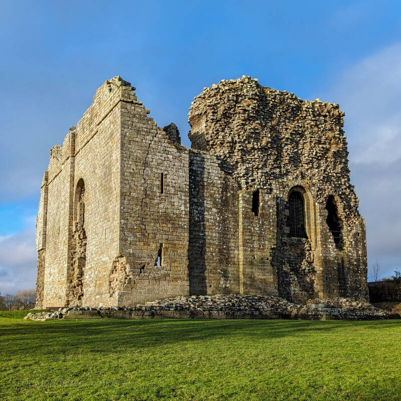
Bowes Castle
The striking remains of Bowes Castle stand above the village, a reminder of the days when this important Pennine crossing was guarded by kings, soldiers and travellers.
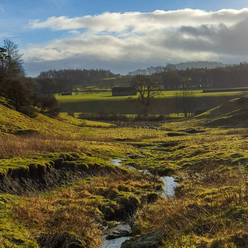
Open Teesdale Countryside
The walk crosses soft rolling countryside with wide views across the River Greta valley beneath Bowes Castle.
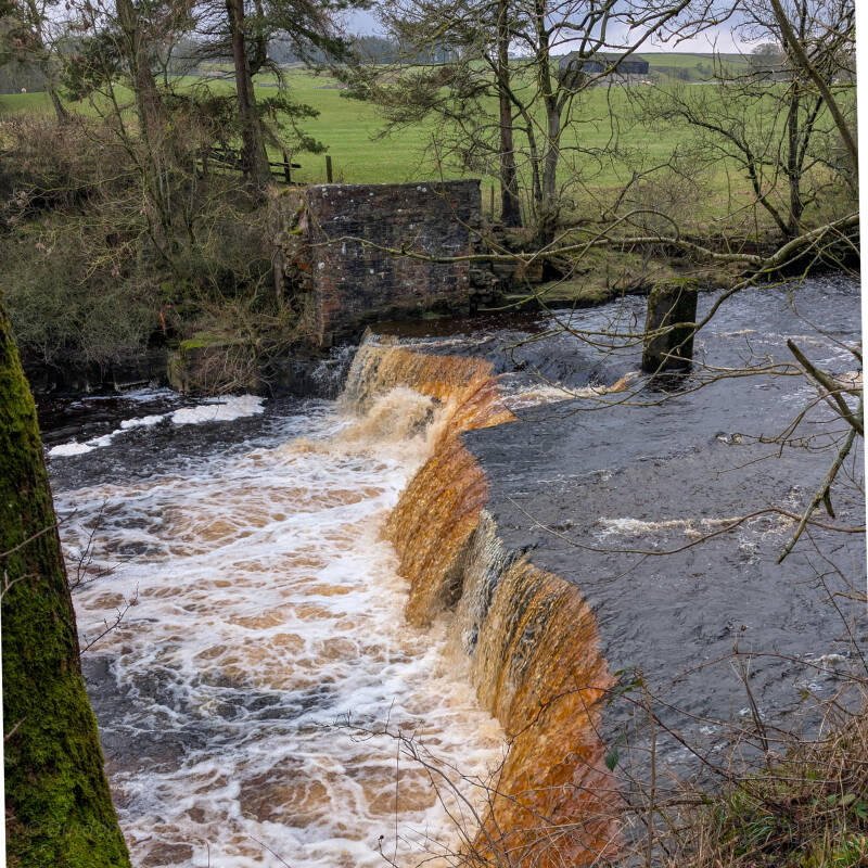
Mill Force Waterfall
Hidden beneath the trees, Mill Force is a peaceful waterfall on the River Greta, sitting beside the site of the old corn mill that once served Bowes village.
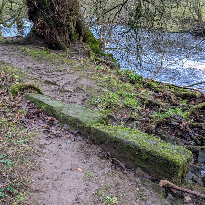
Remains of the Old Mill
A few surviving stones near the waterfall hint at the corn mill that once stood beside the River Greta.
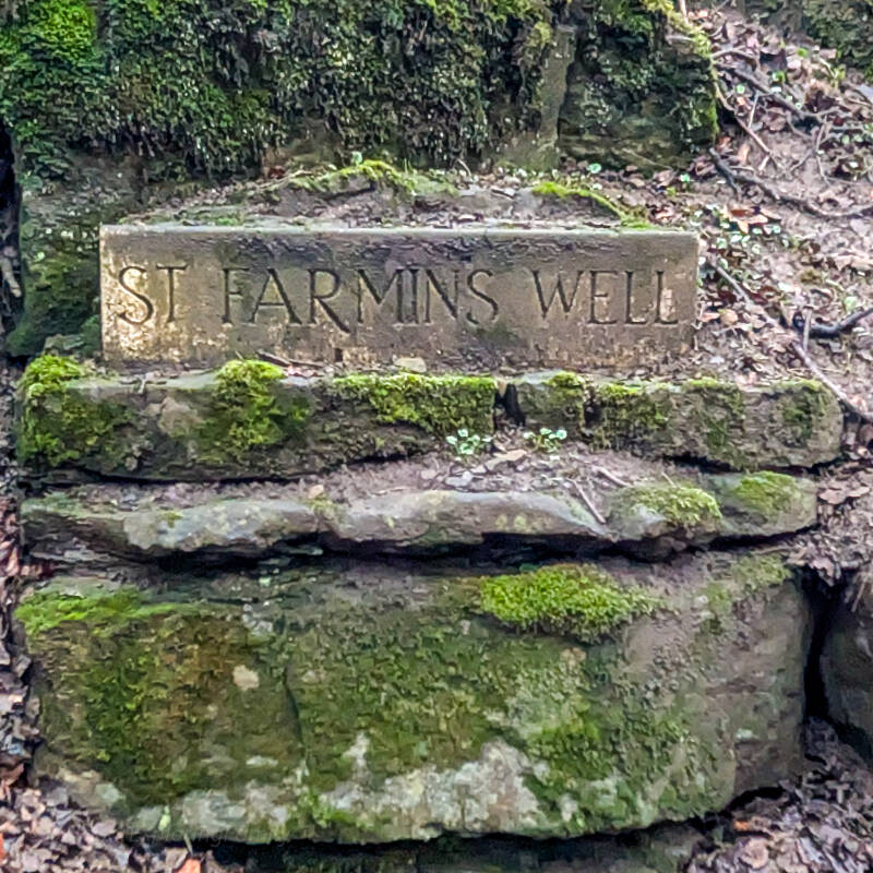
St Farmin’s Well
The carved stone marking St Farmin’s Well still survives quietly beside the woodland path near Gilmonby Bridge.
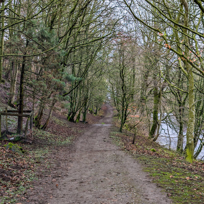
Woodland Path to Gilmonby Bridge
The peaceful riverside path follows the River Greta through woodland before leading towards Gilmonby Bridge.
Why This Walk Stays With You
What makes this route memorable is how much history and scenery fit naturally into such a short distance.
You begin beside Bowes Castle, cross open countryside, follow the River Greta through woodland and visit a waterfall that once helped power a local corn mill. It is a simple walk, but one that brings together many different parts of Bowes' history and landscape.
It feels calm now, but the landscape still carries echoes of everything that came before it.
Discover More in Teesdale
If you enjoyed this walk, there is plenty more to explore across Teesdale.
Start with our Discover Teesdale homepage, where you'll find waterfalls, walks, local history and some of our favourite places across the dale.
Looking for another easy walk? Try our Barnard Castle Circular Walk, a 2.5 mile route that follows the River Tees and offers some of the best riverside scenery in the area.
For a peaceful village walk, our Romaldkirk Circular Walk takes you past Low Garth Farm and the fascinating Fairy Cupboards, one of Teesdale's most unusual geological features.
If you'd like something a little longer, the Cotherstone Moor Walk is approximately 6.5 miles and explores a quieter side of Teesdale, passing the abandoned East Loups and West Loups farmsteads along with prehistoric rock art hidden amongst the moorland landscape.
Wherever you choose to explore next, we hope you enjoy discovering a little more of what makes Teesdale such a special place.