Blackton Reservoir Rock Art, Baldersdale
Prehistoric rock art can still be found across parts of Teesdale, including a recorded site close to Blackton Reservoir in Baldersdale, not far from Barnard Castle.
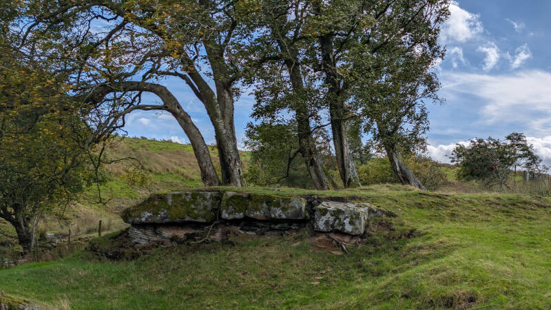
The rock lies on the south side of the reservoir area near Mere Beck. We went looking for it in September 2026 and found a broad area of exposed stone, with much of the surface disappearing beneath grass and thick moss.
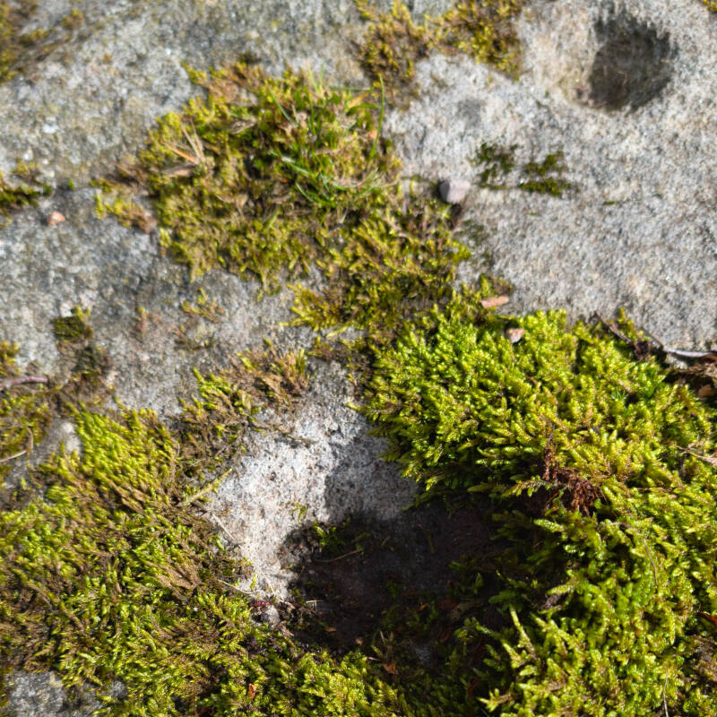
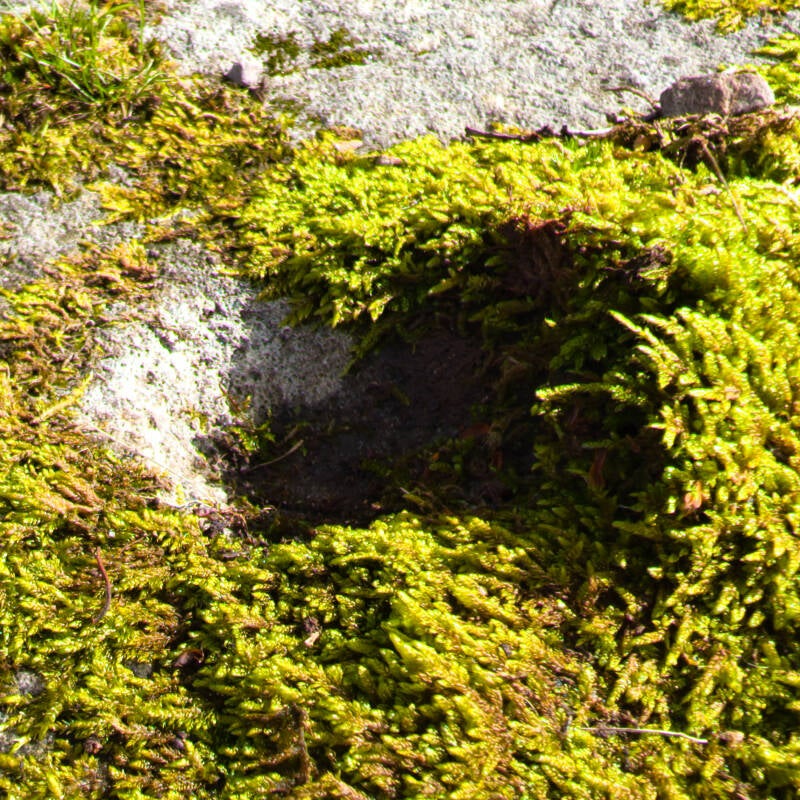
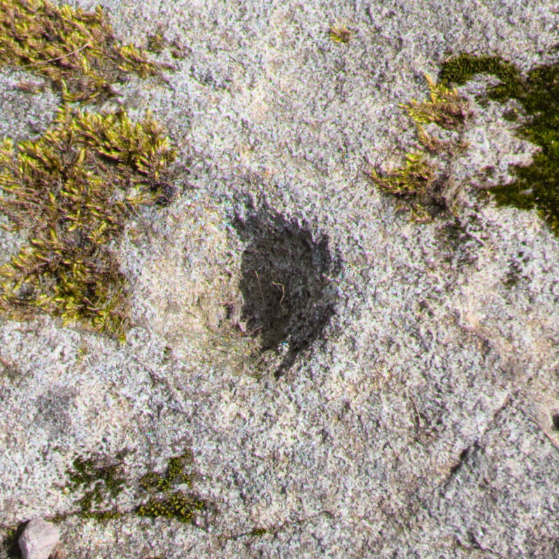
Two rounded indentations were clearly visible on the uncovered rock. We didn't pull back the moss or disturb anything to look for more; we simply photographed what we could see and left the site exactly as we found it.
Quick Facts
Location: Baldersdale, Teesdale, County Durham
Near: Blackton Reservoir and Mere Beck
Nearest village: Cotherstone
Grid reference: NY 94845 18555
Coordinates: 54.562200, -2.081232
Site type: Recorded prehistoric rock art
General period of this rock-art tradition: Neolithic to Early Bronze Age
General date range: Around 3800 BC to 1500 BC
What we saw: Two rounded indentations on the exposed surface
Visited: September 2026

What We Found
The rock art is on a low, exposed area of bedrock close to Mere Beck, with the surface broken up by grass, moss and patches of bare stone.
When we visited, much of the rock was covered, but two rounded indentations were clearly visible on the exposed surface. One was surrounded by thick moss, while the other sat on a more open section of stone.
The wider rock surface extends beneath the vegetation, so only part of the panel could be seen during our visit. We left the moss and grass untouched and photographed the features that were already exposed.
The site is recorded as prehistoric rock art, with cup and cup-and-ring markings known from this area of bedrock. What you can actually see on a visit will depend on how much of the rock is exposed at the time.
What is Prehistoric Rock Art?
When archaeologists talk about prehistoric rock art in northern England, they usually mean a particular group of carvings made on natural rocks and boulders during the later Stone Age and Early Bronze Age.
The simplest markings are cup marks — shallow, bowl-shaped hollows in the surface of the stone.
A cup-and-ring mark has a cup surrounded by one or more circular grooves. Other panels can contain straight or curving grooves and combinations of several different markings.
They aren't pictures in the way we normally think of art today. They generally don't show recognisable people, animals or objects. Historic England describes them as abstract markings whose original meaning is unknown.
The carvings could be made in several ways. Archaeological evidence shows that some were scratched out first, while pecking — repeatedly striking the rock with a pointed stone — was commonly used to cut into the surface. Grinding could then be used to smooth parts of the carving.
How Old is Prehistoric Rock Art?
This is where it is important not to give the Blackton Reservoir rock an age that nobody can actually prove.
Historic England places most British rock art of this type within the Neolithic and earlier Bronze Age, roughly 3800 BC to 1500 BC.
So we're talking about a tradition that was being used somewhere between roughly 3,500 and almost 6,000 years ago.
Individual carvings are much harder to date.
An exposed rock surface normally can't be scientifically dated on its own, and rock art is often found without pottery, charcoal or other remains that could provide a firm date. Archaeologists instead build the picture by studying carvings found alongside datable prehistoric monuments and comparing different sites.
What Did the Marks Mean?
Nobody knows for certain.
And I think that's one of the most interesting things about them.
The people who made these markings left no written explanation, and the designs don't appear to be straightforward pictures of recognisable things. Historic England says they may have carried an unknown, possibly sacred meaning, but there is no single explanation accepted as fact.
There are some interesting ideas.
Some carved stones became associated with prehistoric burial monuments, which is one reason ritual or symbolic meanings have been suggested. Archaeological investigation elsewhere has also found evidence of activities around some rock-art panels, including fires and possible deposits.
Another line of research looks at where the rocks were placed in the landscape.
Some prominent rock-art panels overlook low ground or natural passes. This has led archaeologists to consider whether certain rocks could have helped mark territories, routes or important places.
But it isn't as simple as saying they were prehistoric signposts. Other carved rocks are difficult to see even from close by, suggesting that different panels may have been used in completely different ways.
The tradition also lasted for a very long time and covered a huge area, so the same shapes may not always have meant the same thing.
For now, the simplest answer is probably the best one: we know people deliberately carved these strange symbols into rock thousands of years ago, but we no longer know what they meant.
Prehistoric Rock Art Across Teesdale
The Blackton Reservoir site isn't on its own.
There are other recorded prehistoric carved rocks across this part of Teesdale, with particularly good examples around Cotherstone Moor and Goldsborough Rigg.
Historic England protects several of those rocks as Scheduled Monuments. One on Cotherstone Moor contains cup-and-ring markings, while Goldsborough Rigg has several recorded carved rocks containing combinations of cups, rings and grooves.
That wider picture is what makes the Blackton Reservoir site especially interesting to me.
Today Baldersdale is dominated by reservoirs, farms, walls and tracks, but people were moving through and marking this landscape thousands of years before any of those existed.
The exposed rock beside Blackton Reservoir is a small surviving part of that much older Teesdale.
Explore More
If you enjoy finding the older stories hidden across the dale, head back to our History & Heritage section for more archaeology, ruins and historic places around Teesdale.
You can also explore our full Discover Teesdale guide for walks, waterfalls, reservoirs, villages and places to visit across the area.
And if you’re out exploring, open the Discover Teesdale app to use the interactive map, find places nearby and discover more around you.