God's Bridge Walk from Bowes
If you're looking for a walk that combines Teesdale history, riverside scenery, open countryside and one of the most unusual natural features in County Durham, this route is hard to beat.
Starting in the village of Bowes, the walk passes Bowes Castle before following the River Greta through peaceful farmland and along part of the Pennine Way. Along the way you'll cross the river beside an old weir, discover the natural limestone bridge known as God's Bridge, pass historic lime kilns and finish with a visit to Mill Force waterfall.
Although God's Bridge is the main destination, this walk offers much more than a single landmark. It is a route that encourages you to slow down, take your time and enjoy the landscape around you.
Quick Facts
Distance: 6.8 miles
Route type: Circular walk with shared riverside section
Difficulty: Moderate
Terrain: Riverside paths, field tracks, country lanes and open access land
Time: 3 to 4 hours
Start point: Bowes and Gilmonby Village Hall
Postcode: DL12 9HU
Parking: Free village hall car park
Dog friendly: Yes
Pushchair friendly: No
OS Map: Explorer OL31 North Pennines
Digital guide: Hiiker route available
GPX file: Free GPX download available

Parking and Access
This walk starts from Bowes and Gilmonby Village Hall at the bottom of Bowes.
The free car park provides a convenient starting point and sits only a short walk from Bowes Castle and the River Greta. The route uses public footpaths, sections of the Pennine Way, country lanes and open access land above the river valley.
Good walking boots are recommended, particularly after wet weather when riverside sections can become muddy.

Route Overview
From the village hall, walk up through Bowes village and turn left at the church. The route passes Bowes Castle before continuing beyond the castle walls and down towards the River Greta.
Cross the footbridge beside the weir and follow the riverside path which forms part of the Pennine Way. This section follows the Greta through open countryside towards East Mellwaters. Keep an eye across the river where traces of the old railway route can still be seen in the landscape.
The path continues beside the river until reaching God's Bridge. Here the River Greta flows beneath a natural limestone bridge that has formed over thousands of years.
After visiting God's Bridge, leave the river and climb onto the open moorland above. Turn left across the access land before gradually descending back towards East Mellwaters.
The return route follows the River Greta back towards Bowes. Shortly before reaching the village, take the riverside path to Mill Force where the remains of the old mill can still be seen beside the waterfall.
From Mill Force continue to Gilmonby Bridge before returning along the road to Bowes and the village hall.
Things You Will See on This Walk
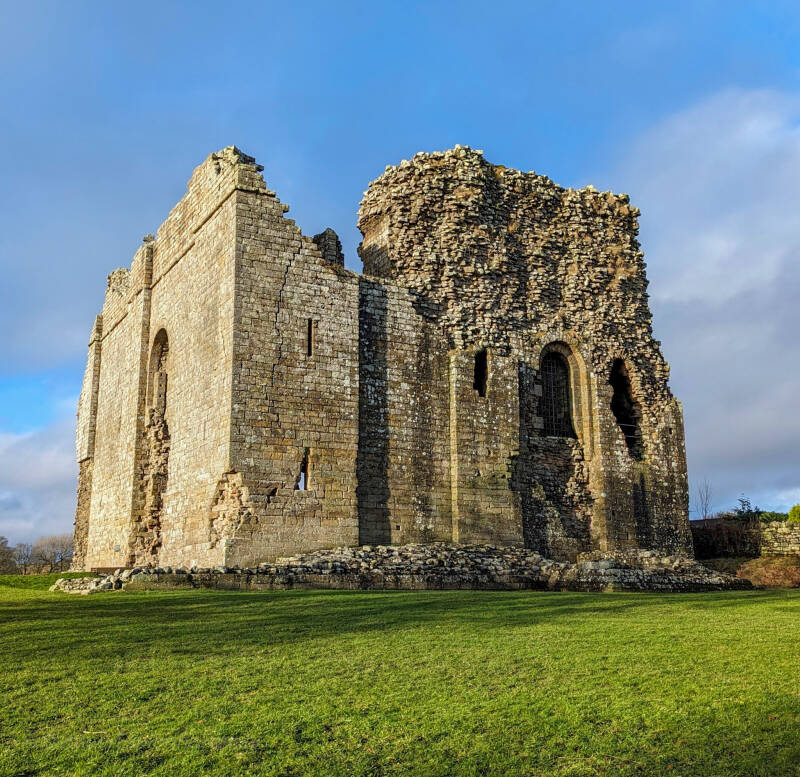
Bowes Castle
Built during the reign of Henry II, Bowes Castle stands on one of the most important historic routes across northern England.
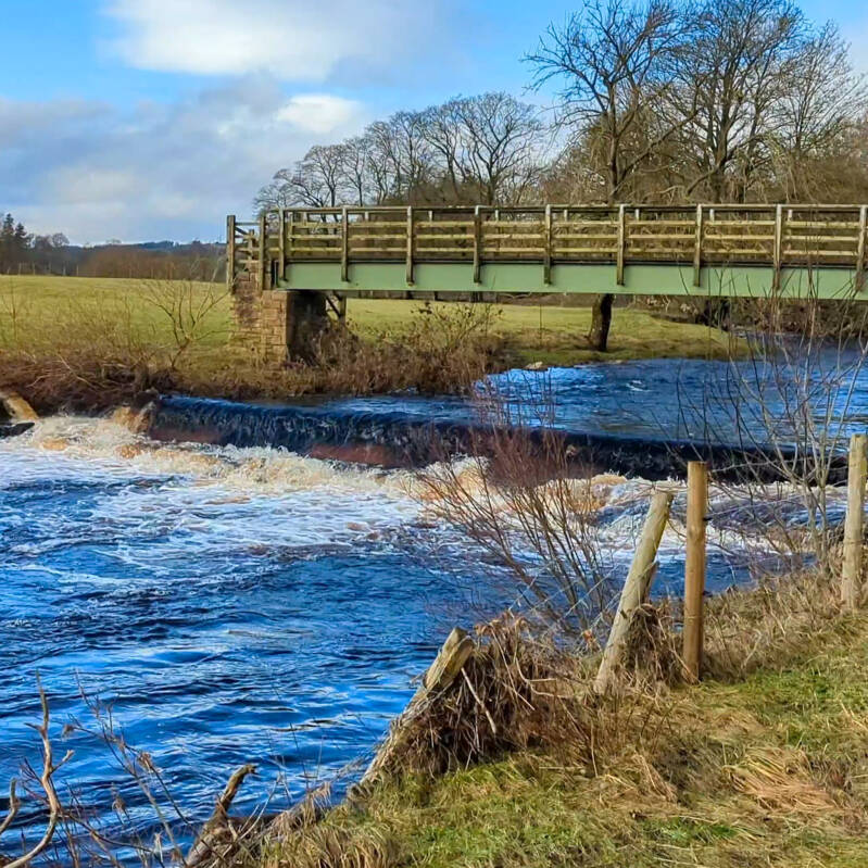
River Greta Weir and Footbridge
The crossing beside the weir marks the start of the riverside section of the walk. It is a lovely spot to pause and watch the water flowing beneath the bridge.
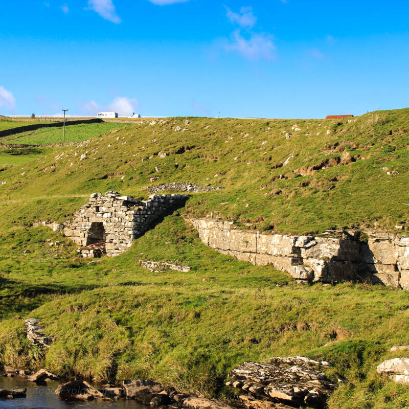
Historic Lime Kilns
Near God's Bridge stand two Grade II listed lime kilns dating from the early nineteenth century. Built into the hillside, they once produced agricultural lime for farms across the surrounding countryside.
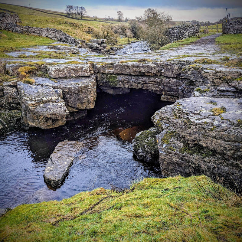
God's Bridge
One of the most unusual natural features in Teesdale, God's Bridge was created as the River Greta gradually shaped the limestone beneath it. Today the river flows through the rock bridge below, creating a fascinating geological landmark.
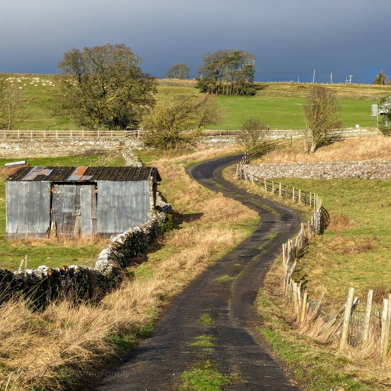
Country Lanes and Open Moorland
A short section of the walk crosses quiet country lanes surrounded by dry stone walls, open fields and classic Teesdale countryside.
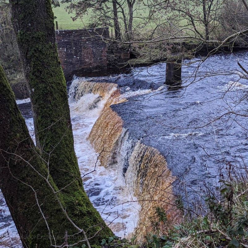
Mill Force Waterfall
The final highlight of the walk is Mill Force. The waterfall sits beside the remains of the old mill and provides a peaceful place to pause before returning to Bowes.
About God's Bridge
God's Bridge is one of the most remarkable natural landmarks in Teesdale.
Over thousands of years, water has gradually shaped the limestone beneath the River Greta, creating a natural rock bridge with the river flowing through the channel below. The feature is protected as part of a Site of Special Scientific Interest and is one of the best known natural rock bridges in England.
Standing beside the bridge today, it is easy to appreciate the power of nature and the timescales involved in shaping the landscape around us.
Why Is It Called God's Bridge?
Nobody knows exactly when the name first appeared, but for centuries local people have referred to the natural rock crossing as God's Bridge. Standing beside it today, it is easy to understand why. The River Greta disappears beneath solid limestone before reappearing downstream, creating a landscape feature that still feels remarkable even after countless visits.
It's More Than Just a Walk
One of the things we enjoy most about this route is how quickly it helps you slow down.
There is always something to notice along the way. The sound of the River Greta flowing through the valley. The shape of the limestone around God's Bridge. The remains of the old lime kilns built into the hillside. The views across the open countryside above the river.
This is not a walk about rushing from one landmark to the next.
It is about taking your time, enjoying the landscape around you and reconnecting with nature along the way.
Sometimes the best part of a walk is simply slowing down enough to notice the small things. This route gives you plenty of opportunities to do exactly that.
Explore More in Teesdale
Discover Teesdale
Explore waterfalls, walks, local history, dark skies and some of our favourite places across Teesdale.
Bowes Castle and Mill Force Walk
A short circular walk from Bowes featuring Bowes Castle, Mill Force waterfall and peaceful paths beside the River Greta.
Waterfalls of Teesdale
From High Force and Low Force to lesser known waterfalls across the dale, discover some of the best waterfalls in Teesdale.
Barnard Castle Circular Walk
A gentle riverside walk exploring Barnard Castle, the River Tees and some of the area's best views.
Romaldkirk Circular Walk
A relaxed village walk combining riverside scenery, local history and the fascinating Fairy Cupboards.