Brignall Banks, Rokeby and Mortham Circular Walk
This 9.4-mile circular walk from Greta Bridge explores one of the most varied and atmospheric corners of lower Teesdale, combining riverside paths, old woodland, open farmland and quiet country lanes.
Along the way, the route passes Old St Mary’s Church at Brignall, the wooded slopes of Brignall Banks, a little-known cave beside the path, St Mary’s Church at Rokeby, the Meeting of the Waters and Mortham Tower.
Although it is a longer walk, there are no major climbs and much of the route is fairly gentle. This is one to take steadily, leaving time to pause by the River Greta, explore the old churches and notice the history held in the landscape. Greta Bridge is less than eight miles from Barnard Castle, making it a rewarding longer walk for anyone wanting to discover a quieter side of Teesdale.
* marks affiliate links. If you buy or sign up, we earn commission at no extra cost to you.
It helps cover website costs and keeps our guides free.
Quick Facts
Distance: 9.4 miles circular
Time: Around 4 to 5 hours, but allow longer if you want to stop and explore
Start and finish: Greta Bridge
Postcode: DL12 9SE
Parking: Limited roadside parking near Greta Bridge where permitted
Route type: Circular walk
Terrain: Open fields, woodland paths, farm tracks, country lanes and short road sections
Difficulty: Moderate
Elevation: Gentle overall
Dog friendly: Yes, but dogs should be kept under close control around livestock and roads
OS Map: Explorer OL31 North Pennines*
Digital route: View the route*
GPX file: Free download available

Parking, Access and Important Information
There is no designated public car park for this walk.
We started near The Morritt Hotel at Greta Bridge, using postcode DL12 9SE. The hotel car park is for customers only, but there is limited roadside parking nearby. Please park considerately and avoid blocking homes, gateways, farm entrances or turning spaces.
The route follows public rights of way through farmland, woodland, quiet lanes and the grounds of Mortham Tower. The tower and surrounding buildings are privately owned, so keep to the marked footpath.
Most of the walk is fairly gentle, but the section through Brignall Banks is rougher. The path can be slippery after rain, overgrown in summer and close to steep drops above the River Greta. There are also several stiles, short road sections and fields with livestock, so dogs should be kept under close control.
The main hazard is the direct crossing of the A66 near Rokeby. There is no bridge or underpass at this point. Traffic can be fast, so wait until you have a clear view in both directions and plenty of time to cross safely.
There are no public toilets, shops or refreshment stops along the route, so carry enough food and water for the full walk. The Morritt Hotel is a good place to stop for a drink or meal afterwards.
Bertram’s Cave lies beside the River Greta opposite Eastwood Hall, but it is fenced off on private land and cannot be visited from this route. You do, however, pass a different cave later in Brignall Banks. This separate, unnamed cave sits directly beside the public footpath and is easy to see as you walk through the woods.

The Route
Greta Bridge to Brignall Old Church
Start near The Morritt Hotel at Greta Bridge and walk towards the bridge. Just before you reach it, turn right and cross the stile over the wall into the field.
The large house ahead was once the George Inn. Greta Bridge once had three inns serving travellers passing through this busy crossing point, and although the Morritt Arms is the best known today, the old George Inn is a reminder of how important the road once was.
Follow the public footpath across the open fields above the River Greta. The walking is gentle here, with farmland around you and the wooded Greta valley slowly drawing closer.
Across the river, near Eastwood Hall, is Bertram’s Cave. It is marked on old maps and linked with Sir Walter Scott’s Rokeby, but it sits on private land and cannot be reached from this route.
A little further on, look for a stile on your left. This leads down towards the river and Scotchman’s Stone, a large boulder standing in the Greta that was painted by John Sell Cotman. It is a short optional detour and well worth taking if the path is clear and river conditions are safe.
Return to the main route and continue towards the remains of Old St Mary’s Church at Brignall. The ruined church stands quietly above the River Greta and is one of the most memorable stops on the walk.
The building probably dates from the thirteenth century, was altered in later years and was largely demolished after a new church was built in 1833. Only part of the old structure survives, but the broken walls and pointed arch still hold a real sense of place.
Take a little time here if you can. Behind the church, a path drops carefully towards the river, where the view upstream along the Greta is one of the best on the whole route.
Through Tebb Wood and Brignall Banks
From the church, continue into Tebb Wood and follow the River Greta upstream through Brignall Banks.
The first section of woodland follows a steady path with the river below. It is a peaceful stretch, but the ground can become slippery after rain and there are places where the bank drops steeply towards the water, so take care with your footing.
As you move deeper into Brignall Banks, the path becomes rougher and more enclosed. In summer, the vegetation can grow across the route and make it harder to follow, especially in the second half of the woodland.
Take your time and keep checking the line of the path. This is the least polished part of the walk, but it is also one of the most atmospheric, with the River Greta, exposed rock and dense woodland all closing in around you.
As the river bends sharply to the right opposite Black Scar, the Brignall Banks cave appears directly beside the path.
It is easy to spot once you reach it. The dark entrance sits beneath broken rock, hanging roots and trees growing above the opening, and it feels like a proper little surprise in the middle of the woods.
Very little seems to be recorded about this particular cave, and it should not be confused with Bertram’s Cave farther down the river. Its age and original use are unclear, but that lack of information is part of what makes it so interesting.
Enjoy it from the entrance and avoid disturbing any loose stone. From here, continue through the woodland as the path gradually climbs away from the River Greta.
Brignall Banks to Brignall Village
The woodland path eventually reaches a single-track road. Turning left would take you towards Brignall Mill, but for this circular walk, turn right.
Look out for the unusual seat beside the track before continuing uphill past Moor House Farm and Moor House Cottage.
At the next junction, turn right and follow the quiet road down through Brignall Lane. This is a gentle section through open countryside, passing farms, fields and old stone buildings.
Continue until the road approaches a sharp left-hand bend. Just before the bend, turn left through the farm and follow the public footpath around the outside edge of the field.
Once you have passed the farmhouse, look across to your right. You should be able to see the present St Mary’s Church at Brignall, built to replace the older riverside church you passed earlier.
Carry on through the fields towards Graham Gill and Jack Wood. The route opens out here, with wider views across the countryside and a very different feel from the enclosed paths of Brignall Banks.
Follow the public rights of way through the woodland and into the final fields before the A66. At the right time of year, look out for wild poppies growing among the crops and along the field edges.
Brignall to Rokeby
The route now reaches the A66.
There is no bridge or underpass at this crossing point, so extra care is needed. This is a single-carriageway section, but traffic can still be fast.
Stand well back from the road, make sure you have a clear view in both directions and only cross when there is plenty of time. Do not rush the crossing.
Once safely over, you will arrive beside St Mary’s Church at Rokeby.
The church sits close to the road, but inside the churchyard it feels much calmer. Its stone frontage, red door and simple bellcote give it a very different character from the ruined church at Brignall.
From the church, continue straight ahead through the open fields until the path reaches the road leading between Barnard Castle and the A66.
Maps suggest a public right of way dropping towards the River Tees through Paradise Wood, but when we walked the route, we could not find a clear or usable way down to the river.
Rather than force a route across unclear ground, we followed the short road section instead. Turn onto the road, then turn left onto Mortham Lane and follow it towards Dairy Bridge.
The Meeting of the Waters and Mortham Tower
Dairy Bridge crosses the River Greta close to the Meeting of the Waters, where the Greta joins the River Tees.
This is one of the finest places on the walk. The rivers meet among deep pools, broad slabs of rock and woodland, creating a peaceful setting that has attracted writers, artists and visitors for generations.
After following the Greta through fields and woodland for so much of the route, arriving here feels like a natural high point.
Cross Dairy Bridge and follow the public right of way into the grounds of Mortham Tower.
Mortham Tower is privately owned, so remain on the marked public path and respect the privacy of the property. Even from the footpath, it is an impressive sight, with battlements, towers, old roofs and high stone walls making it look more like a small castle than a house.
The tower is also linked with one of Teesdale’s best-known ghost stories, the Mortham Dobby, said to appear as a headless woman trailing white silk behind her. You can read the full story on our Mortham Dobby page.
Continue past the rear of Mortham Tower and around towards the stable buildings, then follow the path beside Mortham Wood.
Return to Greta Bridge
The final section leads back towards the A66, where the route uses an underpass rather than crossing the road directly.
Pass beneath the A66 and continue towards Greta Bridge, following the path back to your starting point near the Morritt Arms.
By the time you return, the walk has taken you through open farmland, old woodland, riverside paths, historic churches, a cave beside the path, the Meeting of the Waters and the grounds of Mortham Tower.
It is a long route, but it never feels like a walk built around distance alone. There is always another story, view or small surprise waiting further along.
A Walk That Keeps Unfolding
This is a long walk, but it never feels like nine miles of the same thing.
One moment you are crossing open fields above the Greta, the next you are standing beside the ruins of an old church or following a narrow woodland path towards a cave. Later, the landscape opens again around Rokeby before the route reaches the Meeting of the Waters and Mortham Tower.
It is the kind of walk where the history does not sit behind glass. It is there in the ruined stonework, the old inns, the churches, the paths and the river crossings.
Take your time with it.
What You Will See
This walk moves through several very different landscapes, from the old coaching buildings at Greta Bridge to open farmland, quiet woodland and the rocky meeting of two rivers.
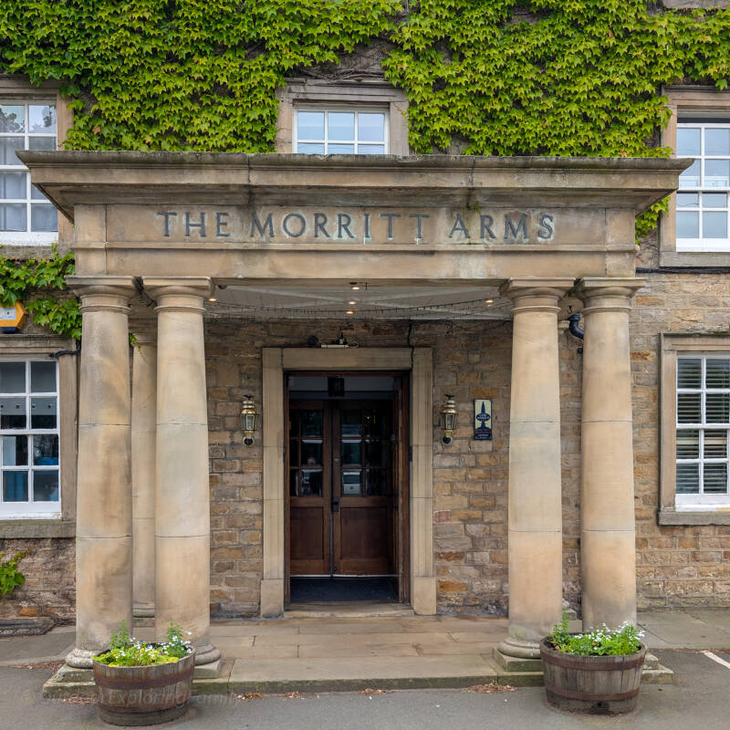
The Morritt Arms at Greta Bridge
The walk starts and finishes beside the Morritt Arms, one of the old inns that once served travellers passing through Greta Bridge.
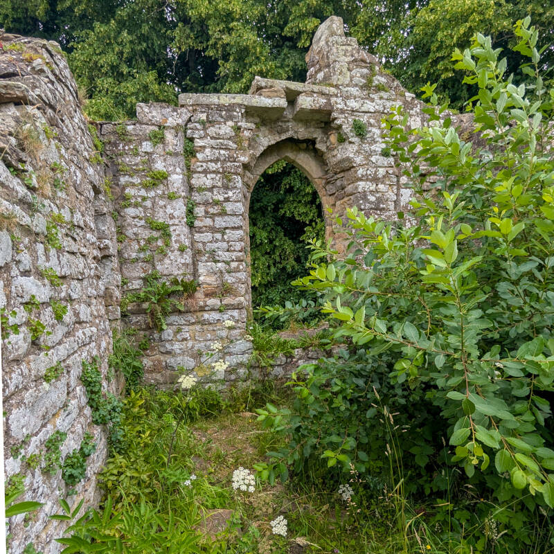
Old St Mary’s Church, Brignall
These quiet ruins sit above the River Greta and are one of the best places on the route to stop and explore for a few minutes.
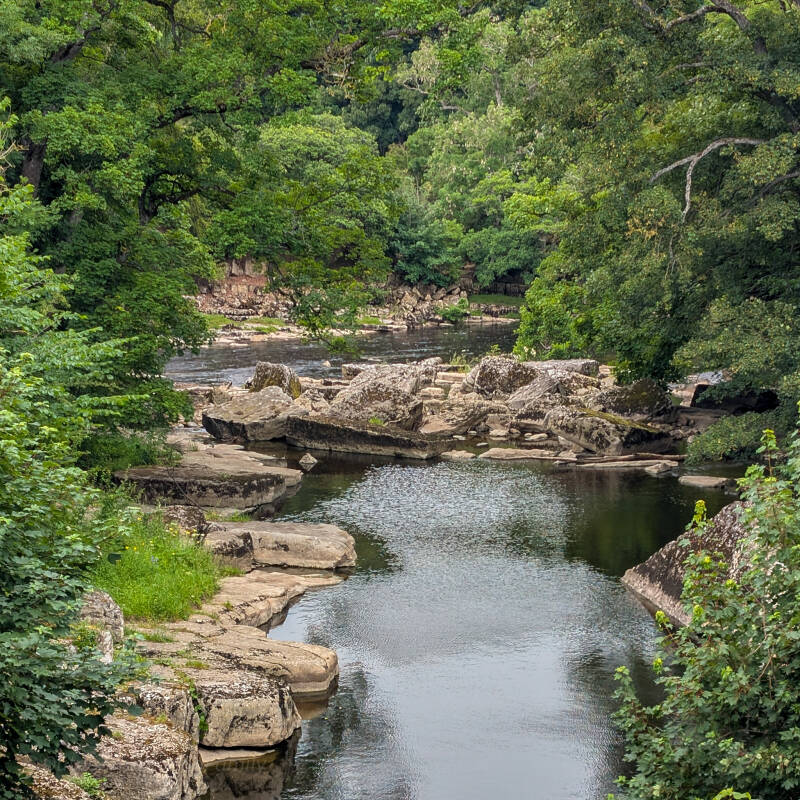
The Meeting of the Waters
This is where the River Greta joins the River Tees, among deep pools, large rocks and woodland.
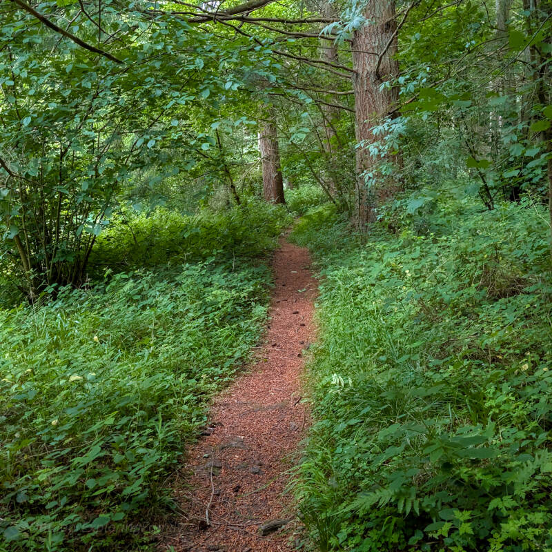
Brignall Banks Woodland
A peaceful but rougher woodland section beside the Greta. The path can be slippery after rain and quite overgrown in summer.
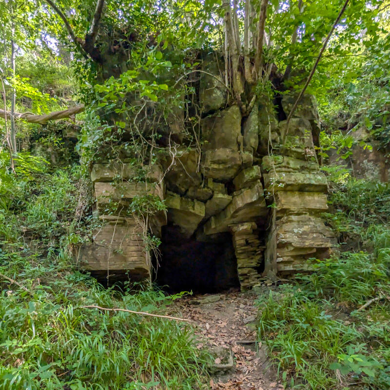
Brignall Banks Cave
The cave appears right beside the path beneath a jumble of rock and tree roots. It is an unexpected little find in the middle of the woods.
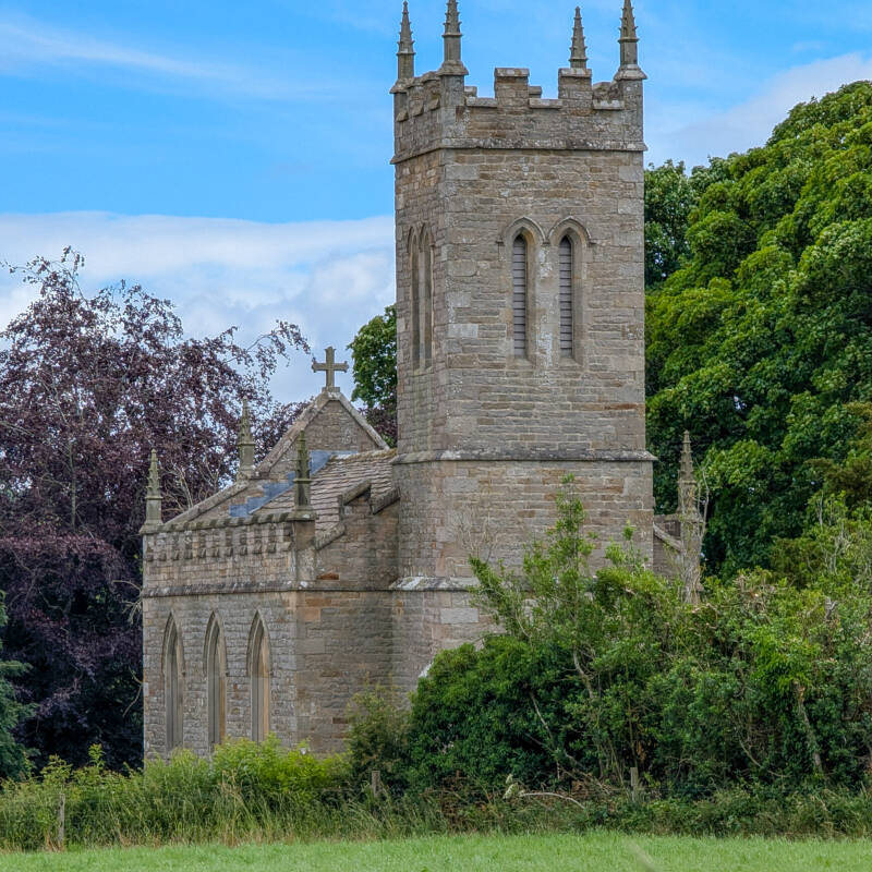
St Mary’s Church, Brignall
The present church can be seen across the fields after leaving Brignall Banks, replacing the older ruined church beside the river.
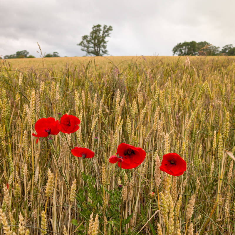
Summer Poppies
At the right time of year, bright red poppies grow among the crops and field edges between Brignall and Rokeby.
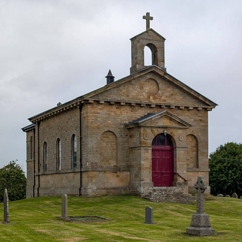
St Mary’s Church, Rokeby
A small stone church with a deep red door, standing quietly beside the A66 in the Rokeby landscape.
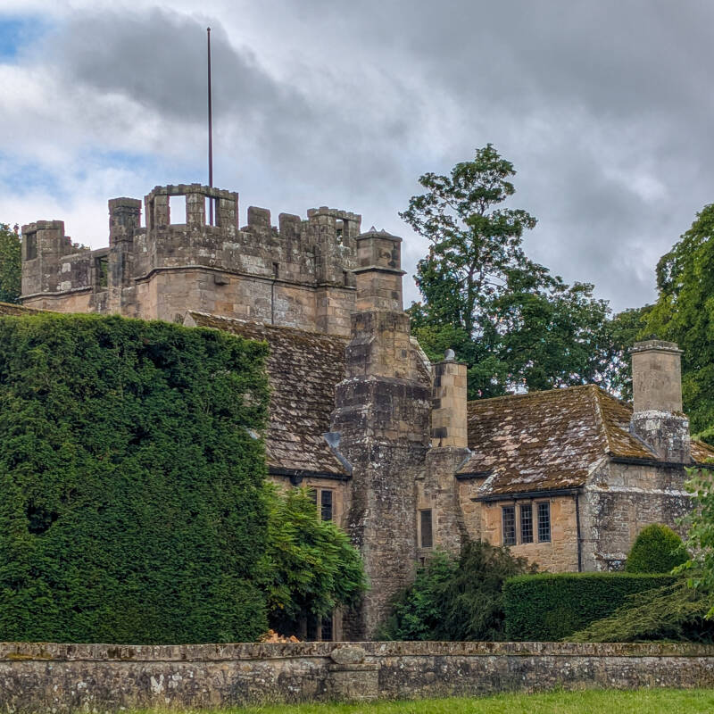
Mortham Tower
The route passes through the grounds of Mortham Tower on a public footpath. The old battlements and towers make it look more like a small castle than a house.
History Along the Route
Greta Bridge may feel quiet today, but it was once a busy stopping place for travellers crossing this part of Teesdale.
There were three inns here: the Morritt Arms, the George Inn beside the bridge, and the New Inn, which stood where Thorpe Farm is today. Coaches, horses and travellers would once have filled this little settlement, making it very different from the peaceful place you walk through now.
The route soon leaves the old road behind and follows the River Greta towards Brignall. Here, the remains of Old St Mary's Church sit above the water, surrounded by trees and old gravestones. The surviving ruins are thought to be mainly medieval and were left behind when a new church was built closer to Brignall village in the nineteenth century.
Further along, Brignall Banks begins to show why this stretch of the Greta became so well known. The river runs between wooded slopes, broken rock and large boulders, creating the kind of landscape that drew artists and writers here.
Scotchman's Stone was painted by John Sell Cotman in the early 1800s, while Sir Walter Scott used the Greta, Brignall and Rokeby landscape in his poem Rokeby. Bertram's Cave on the opposite bank also became part of that literary story, although the cave beside the path on this walk is a different and much less understood feature.
The walk later reaches Rokeby, where another St Mary's Church stands beside the old estate landscape. From there, the route heads towards the Meeting of the Waters, where the River Greta finally joins the River Tees.
It is easy to see why people have paused here for generations. The real beauty of this walk is that none of the history feels separate from the landscape. It is there in the old inns at Greta Bridge, the ruined church above the river, the cave beside the woodland path and the towers at Mortham.
When you slow down and look around, the layers of history begin to reveal themselves.
And somewhere between the fields, the trees and the sound of the rivers, your mind begins to slow down too. That is what makes this route special. It gives you space to breathe, time to notice the small details and a reminder that getting outside is not always about how far you walk, but how much you take in along the way.
A Moment of Calm
By the time you return to Greta Bridge, you have walked through quiet woodland, crossed old fields, stood beside ruined churches and watched two rivers meet.
This is not a walk that asks you to rush. The longer you spend looking around, the more the landscape begins to tell its story.
If you can, pause for a moment before heading home. Listen to the Greta flowing beneath the trees, take one last look across the valley and enjoy the feeling of simply having been outside.
Sometimes the best thing you bring back from a walk is not a photograph or a place name, but a quieter mind.
Explore More Walks Near Barnard Castle
If you enjoyed this walk, you might also like exploring these routes nearby.
Barnard Castle Circular Walk
A gentle riverside walk with beautiful views of the Bowes Museum and River Tees.
Deepdale Woods Walk
Peaceful woodland, hidden history and one of Barnard Castle's quietest nature reserves.
Egglestone Abbey to Meeting of the Waters
A scenic riverside walk linking the abbey ruins with the Meeting of the Waters.
Barnard Castle to Lartington Circular Walk
A varied route through woodland, historic estates and peaceful countryside.