Shacklesborough Circular Walk from Balderhead Reservoir
The Shacklesborough Circular Walk climbs from Balderhead Reservoir onto open North Pennines moorland, reaching the 454 metre summit of Shacklesborough before looping back along the River Balder. At 6.2 miles, it is long enough to feel like a proper upland outing, yet quiet and spacious enough to feel far removed from busier Teesdale routes.
Shacklesborough rises cleanly above the Baldersdale skyline, its flat topped summit marked by a trig pillar and scattered with rough stone and old wall fragments. There are no crowds here and no dramatic cliffs, just open space and long views that give the hill a quiet strength of its own.
This circular walk near Barnard Castle blends reservoir scenery, exposed moorland, subtle history and wide Pennine horizons into one peaceful and rewarding route.
Quick Facts
Distance: 6.2 miles
Time: Approx. 2 hours 20 minutes
Elevation Gain: 676 ft
Walk Type: Circular loop
Start Location: Balderhead Reservoir Car Park
Postcode: DL12 9UX
Parking: Free roadside car park beside the dam
Terrain: Farm track, open access moorland, grassy descent, riverside path and quiet single track road
OS Map: Explorer OL31 North Pennines
Digital Route Map: View the full route on Hiiker

Parking and Access
Parking for this walk is at the main car park beside Balderhead Reservoir, postcode DL12 9UX.
The car park is free to use and sits directly beside the reservoir dam, making it a straightforward and convenient starting point. It’s usually quiet, particularly outside of peak summer weekends, and feels remote in a good way.
There are no facilities here, so bring water, snacks and anything else you may need before setting off. Mobile signal can also be limited in this part of Upper Teesdale.
Access to the surrounding land is open once you leave the dam area, but this is exposed moorland. Weather can change quickly and there is little shelter, so come prepared with suitable footwear and clothing.
It’s a simple start, but one that immediately gives you a sense of the space and calm that defines this walk.

The Walk to Shacklesborough
From the car park at Balderhead Reservoir, head straight across the dam. This is a brilliant way to begin, with water stretching out on both sides and wide Teesdale skies opening up ahead. As you cross, take a moment to look right across the reservoir itself, then left towards Blackton Reservoir, sitting quietly beyond the dam wall.
Once over the dam, follow the track uphill past the farmhouse. The surface here is clear and easy to walk on, gradually gaining height as you leave the reservoir behind. Before long, the track gives way to open access land and the landscape begins to feel bigger and more exposed.
Continue climbing steadily. It is not overly steep, but it is consistent enough to warm the legs early on. Getting this ascent done first means the rest of the walk feels far more relaxed. As you rise onto the moor, bear slightly to your right and you will begin to see Shacklesborough ahead, standing as a raised mound against the horizon.
The approach feels open and spacious. There are no dramatic ridgelines here, just wide upland views in every direction. Underfoot, expect a mix of grass and rough moorland ground. In dry conditions it is straightforward, but after rain it can be soft in places.
As you reach Shacklesborough, take time to explore the summit area. The trig pillar marks the highest point at 454 metres, but the wider mound is what makes it interesting. Raised ground, scattered boulders, and sections of drystone walling give it character. Whether natural or shaped by past use, it has a presence that feels older than the modern landscape around it.
From here, the walking becomes easier as you begin your descent towards Bleagill. The ground slopes downhill and you can choose your own best line, picking the clearest route that suits conditions. Take care on this section, especially if the grass is damp.
Bleagill waterfall is a quiet and modest feature. It only really shows itself after heavy rain, but it makes a peaceful pause point. Even when the flow is light, the sound of water and the sense of space around you make it a good place to stop for a drink.
From Bleagill, continue downhill towards the River Balder and cross over the bridge. After crossing, follow the river downstream. The path becomes easier to see here, gently curving around the gill as it leads you back towards the edge of the reservoir landscape.
Eventually you will reach the single track road that runs alongside Balderhead Reservoir. Turn and follow it back towards the dam. It is a quiet stretch and an easy final section, giving you time to look back across the water and up towards Shacklesborough rising behind you.
Just before returning to the car park, keep an eye out on your left for the remains of an old lime kiln. It is a small but powerful reminder of the working history woven into this landscape.
This circular route combines reservoir views, open moorland, a trig summit, a seasonal waterfall, and a gentle riverside finish. It feels spacious and unhurried, the kind of walk where the calm settles in without you even noticing.
What You’ll See on This Walk
This circular route across Balderhead moorland offers a mix of upland features, open views and subtle traces of Teesdale’s working past. From exposed rock formations and old stone walls to sweeping reservoir scenery, there is plenty to notice if you slow down and look around.
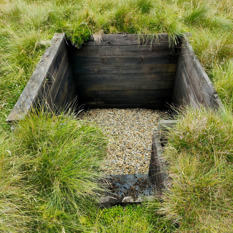
Moorland Grouse Butt
Scattered across the moor you may notice old wooden grouse butts, once used during managed shooting seasons. Weathered and blending into the landscape, they are small reminders of the long history of upland field sports in the North Pennines.
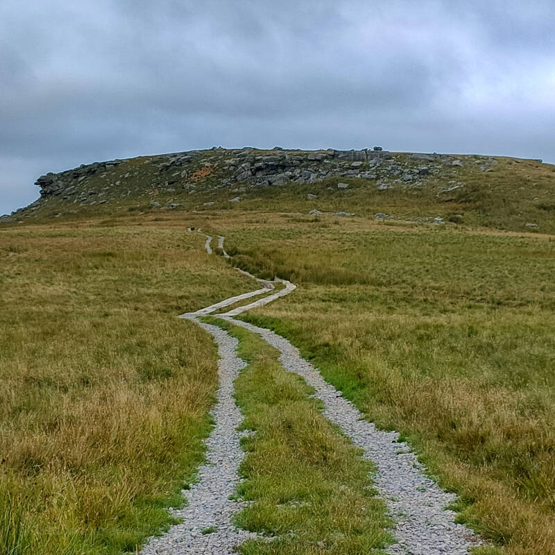
The Track to Shacklesborough
The steady climb follows a clear farm track that winds gently uphill towards the horizon. With big skies above and open grassland all around, it sets the tone for the quiet and spacious feel of this walk.
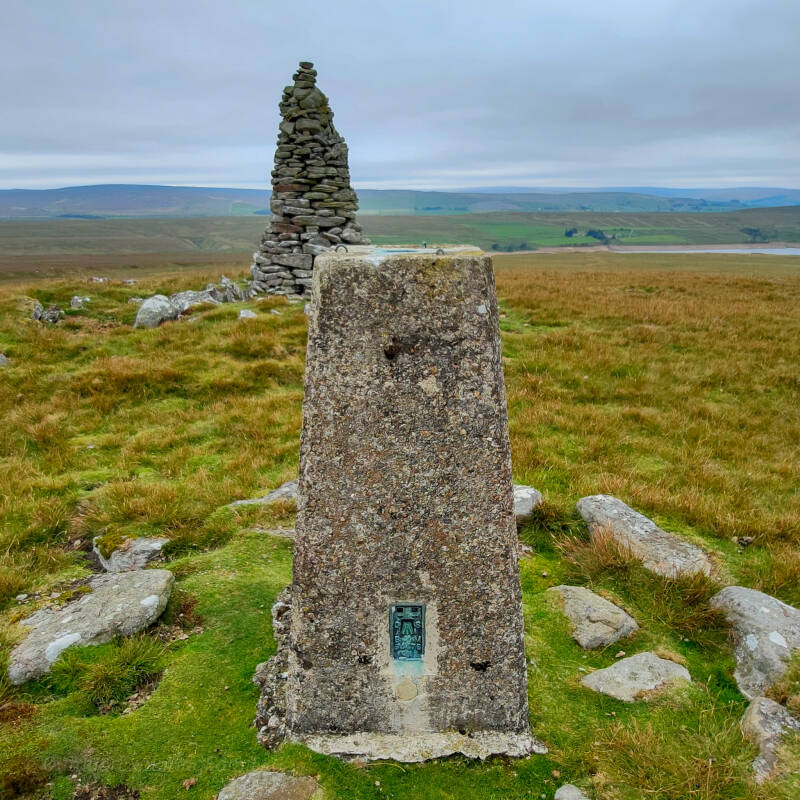
Shacklesborough Trig Point
At 454 metres, the summit trig pillar marks the highest point of the walk. Standing beside it, with the cairn and open moorland behind you, there is a real sense of height, space and Teesdale’s quiet grandeur.
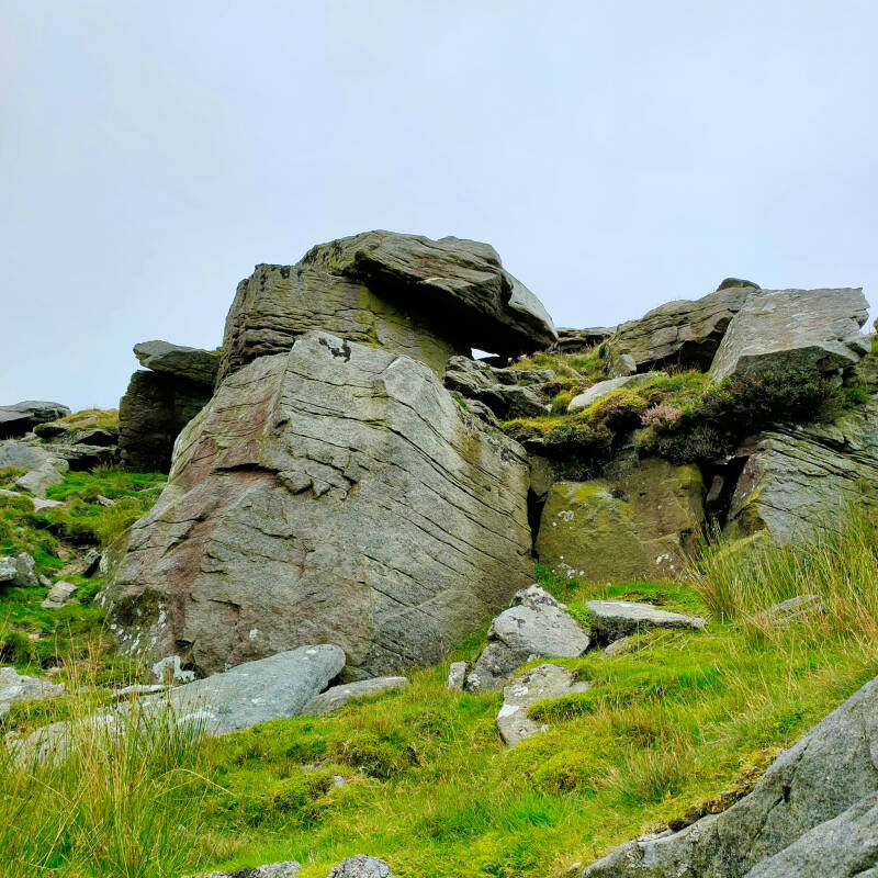
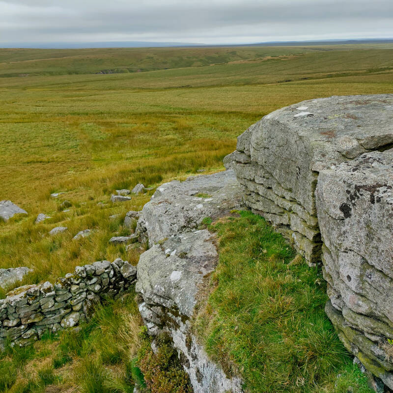
Shacklesborough Rock Formations
Near the summit, large gritstone blocks break through the grass, forming natural outcrops with character and texture. These rugged stones give Shacklesborough its distinctive shape and make the top feel more dramatic than it first appears from below.
Raised Outcrop Views
From the rocky edges, wide views stretch across Baldersdale and the surrounding moorland. On a clear day you can see reservoirs, rolling hills and distant farmland layered across the horizon.
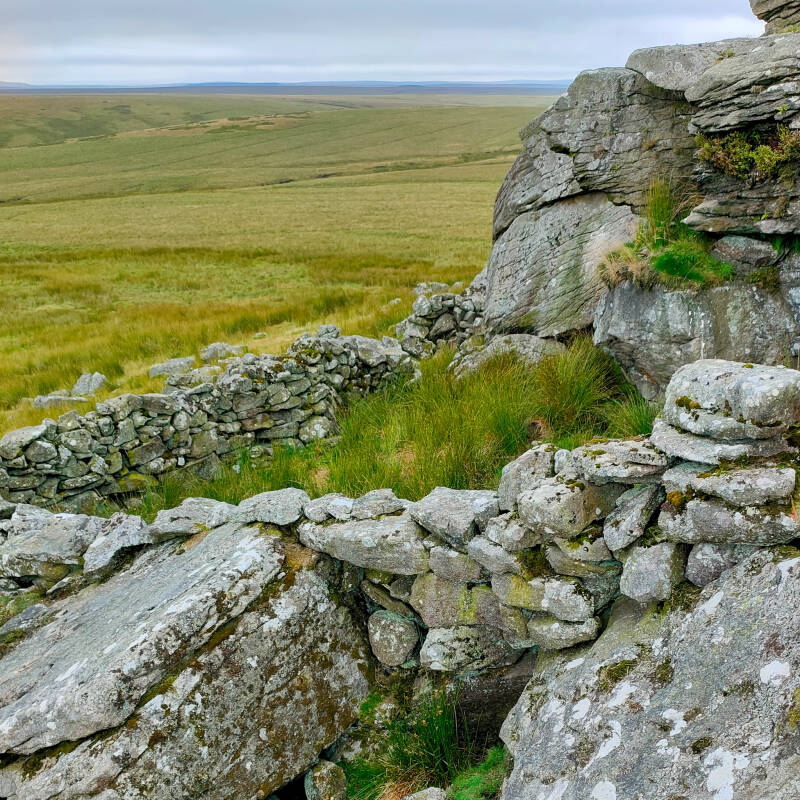
Old Stone Wall Remains
Fragments of drystone walling sit quietly among the rocks, hinting at past land use on the hill. Whether linked to enclosure, grazing or shelter, they add a subtle sense of human presence in this otherwise open landscape.
The History of Shacklesborough
Shacklesborough has long been recognised as a named hill in Upper Teesdale. Historic mapping clearly marks it, and older maps also include the word “currack” nearby, suggesting a feature or enclosure associated with the summit area.
While there is no confirmed archaeological record identifying the site as a medieval farmstead, the raised ground, scattered bolders and fragments of drystone walling indicate that the hill has likely been used or adapted at some point in the past. In upland Teesdale, even small elevated sites were valuable for grazing management, lookout points or temporary shelter.
The name itself has attracted interest. By the late nineteenth century, Shacklesborough was already embedded in local folklore. An 1884 edition of the Teesdale Mercury records that Robin Hood and his men once stood upon Shacklesborough before the outlaw supposedly hurled a giant stone towards Lunedale. That stone became known as Robin Hood’s Pennystone, and the tale was still being repeated decades later in local place name studies.
You can read the full story of Robin Hood’s Pennystone and its link to Shacklesborough here.
In a 1929 article on the place names of Teesdale, the hill is again referenced, confirming that Shacklesborough was an established and recognised landmark in the dale’s cultural memory.
Later newspaper accounts from the 1940s describe sheep clipping gatherings in Baldersdale, mentioning Shacklesborough alongside nearby hills and even an old coal mine in the area. This reinforces its long association with upland farming life.
Today, the summit trig point may be the most visible marker, but the deeper story lies in the quiet continuity of use. Farming, folklore, grazing, quarrying and community traditions have all left their imprint on this landscape.
Shacklesborough may not shout its history, but it carries it quietly across the moor.
A Moment of Calm
Shacklesborough is not a dramatic peak. It does not tower above the landscape or pull in crowds.
It simply rises.
Standing beside the trig point, with wind moving through the grass and the reservoirs spread out below, there is a quiet stillness here. The kind that only comes with open moorland and distance from roads and noise.
The climb is behind you. The hard ground, the stone, the old walls, the stories. Now it is just space.
If you sit for a moment and look across Baldersdale, you can feel how unchanged parts of this landscape still are. Farming continues. Sheep move slowly across the fell. Weather rolls in and passes just as it has for generations.
It is not loud. It is not showy.
But it settles you.
And sometimes that is exactly what a walk should do.
About This Walking Guide
This Shacklesborough Circular Walk was explored and photographed by Outdoor Exploring Family as part of our Discover Teesdale project. All route details are based on our own experience on the ground.
Distances and timings are approximate and will vary depending on pace, weather and ground conditions. This is open moorland terrain with limited shelter and no facilities, so suitable footwear, navigation awareness and sensible preparation are important.
We always recommend carrying an OS map or offline digital route, checking the forecast before setting out, and respecting livestock and working farmland. Please follow the Countryside Code and leave no trace so that these quiet places remain special for everyone.
Explore More in Teesdale
If you enjoyed this walk, you might also like:
Balderhead Reservoir Walk
Hannah’s Meadow Walk
Coldberry Lead Mine Walk
Reservoirs of Teesdale
Teesdale History and Heritage