Hury Reservoir Drawdown and £15 Million Improvement Works
If you know Hury Reservoir, the first thing you notice at the moment is not the machinery around the dam. It is just how much water is missing.
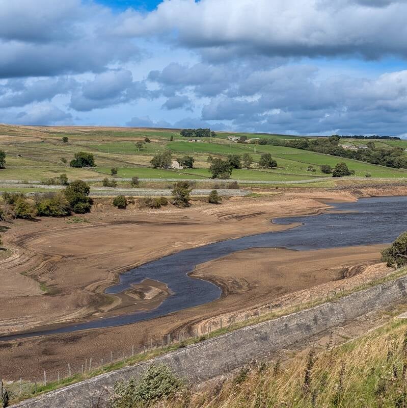
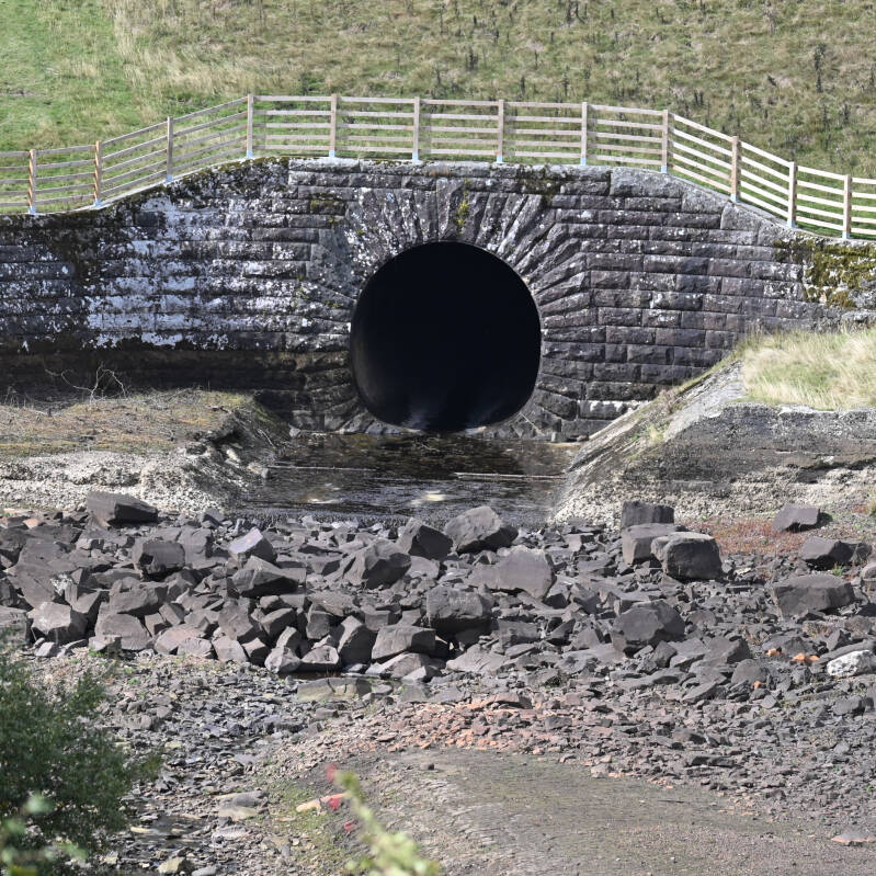
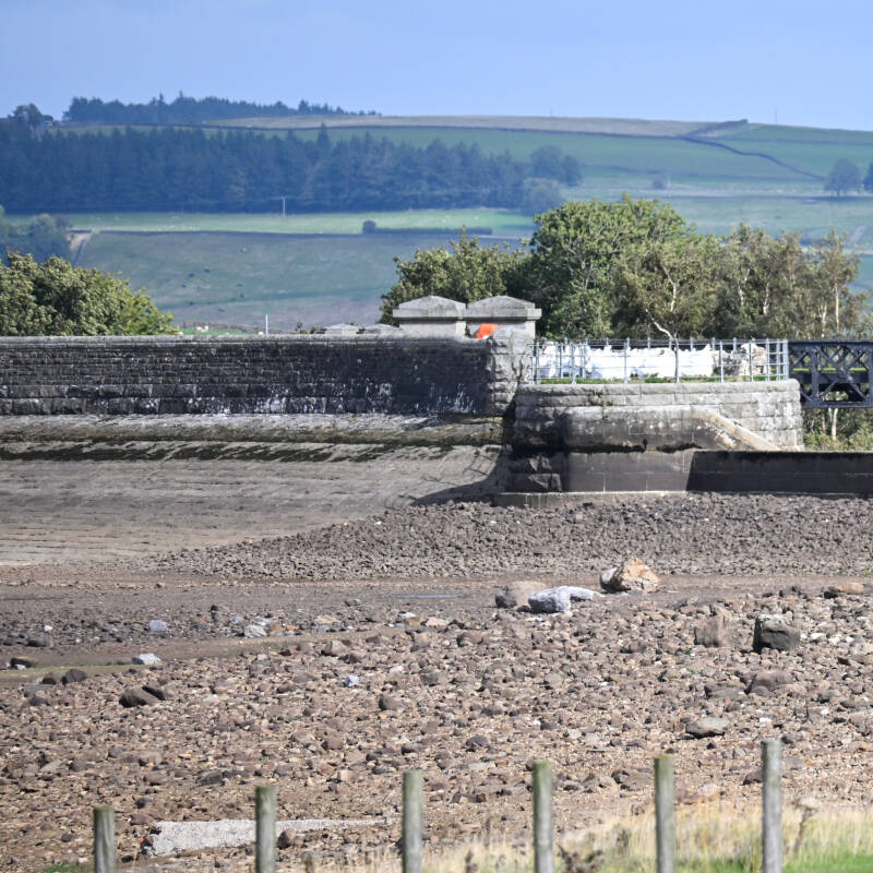
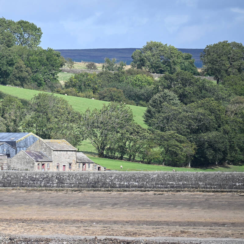
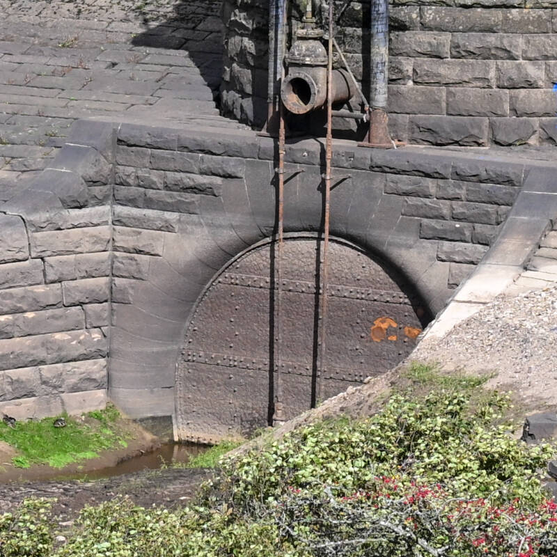
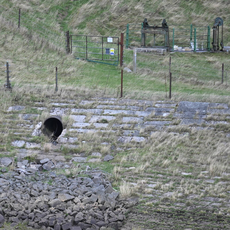
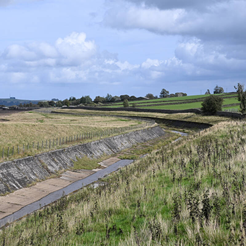
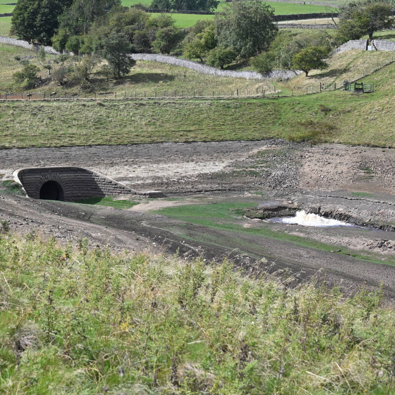
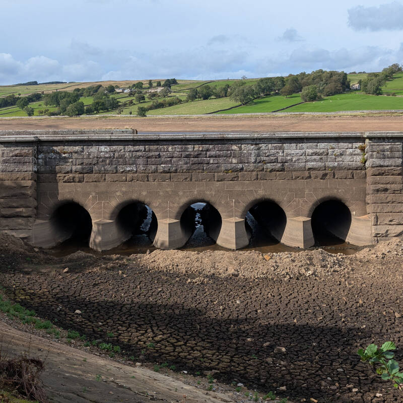
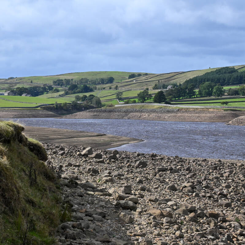
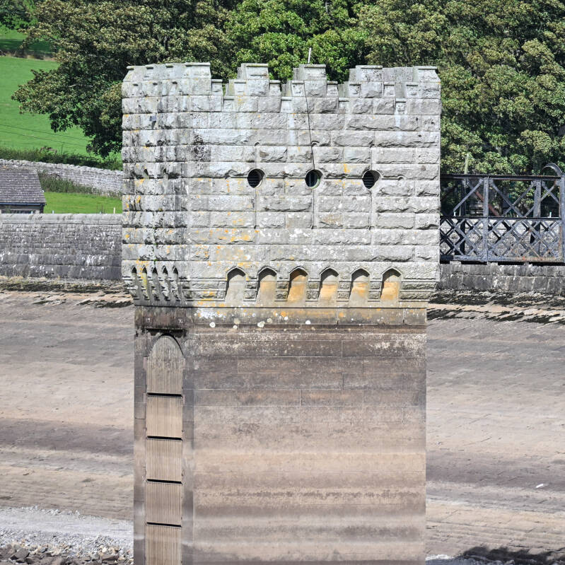
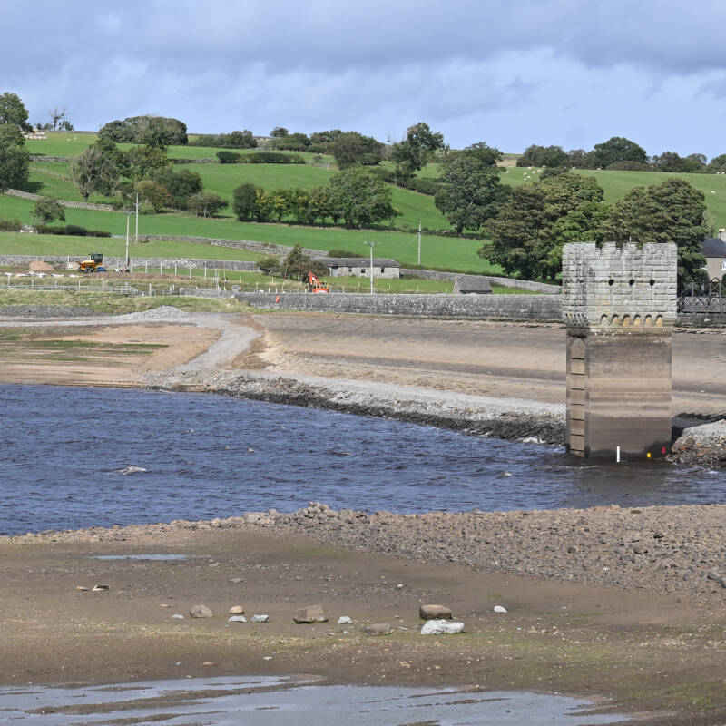
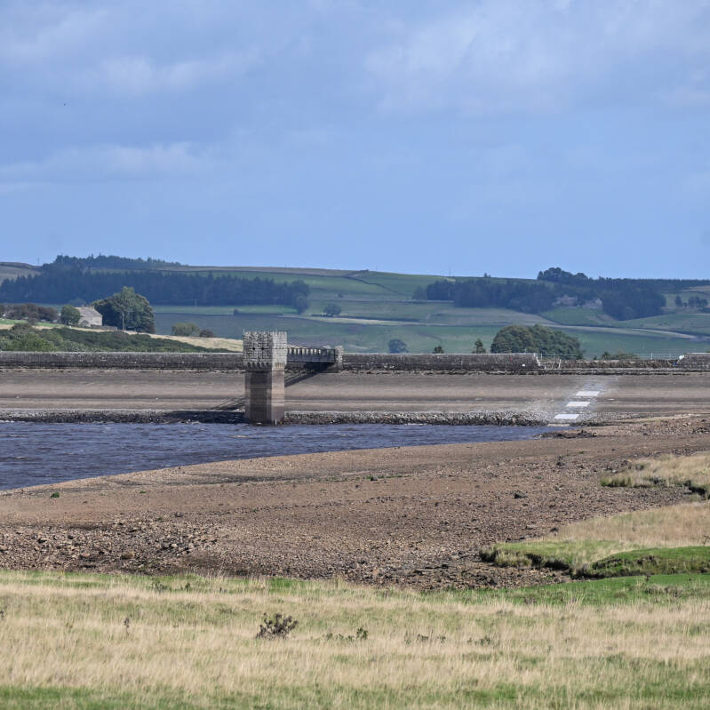
The familiar shoreline has moved a long way out, huge areas of the reservoir floor are exposed and in places Hury looks completely different to the reservoir we are used to seeing. From around the banks you can suddenly see the shape of ground that normally disappears beneath the water, along with stonework, channels and other features that are usually completely hidden.
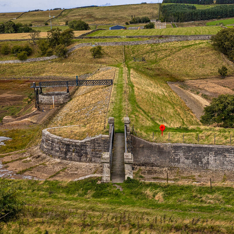
It looks dramatic, but Hury has not simply dried up. The reservoir has been deliberately drawn down since April 2026 while Northumbrian Water carries out a major programme of work costing around £15 million. The project includes improvements to the spillway and a new emergency drawdown syphon system, giving engineers a much faster way of lowering the reservoir if that is ever needed in the future. Work is planned across 2026, 2027 and 2028.
We visited while the water was particularly low and took plenty of photographs because this is a side of Hury that is rarely seen. Once the work is finished and the water returns, much of what is visible now will disappear beneath the reservoir again. As well as explaining what is happening and why, we wanted this page to keep a record of what Hury looked like during a major modern project at the reservoir.
Hury itself is much older. It sits on the River Balder in Baldersdale, west of Cotherstone, and became operational in 1892. The dam was designed by civil engineer James Mansergh and built by Walter Scott and Company of Newcastle for the Stockton and Middlesbrough Water Board. More than 130 years later, Hury is still part of the working water system serving the area.
Quick Facts
Location: Baldersdale, County Durham
River: River Balder
Original reservoir: Operational from 1892
Engineer: James Mansergh
Original contractor: Walter Scott and Company of Newcastle
Current owner: Northumbrian Water
Drawdown: Under way since April 2026
Current investment: £15 million
Main work: Spillway improvements and a new emergency drawdown syphon system
Construction partner: Esh Stantec
Main programme: 2026 to 2028
Why Hury looks so low: The reservoir has been deliberately drawn down for the works

So why have they drained Hury Reservoir?
The simple answer is that Northumbrian Water needs Hury to be capable of lowering its water level much faster than the old system allows.
Hury has always had ways of releasing water. That is part of how a working reservoir operates. The difference is that the standards used to judge how quickly a large reservoir should be able to lower its level have changed. Updated Defra guidance led to reservoirs being assessed against newer drawdown requirements, and Hury was found to have a shortfall.
This matters because being able to lower the water quickly gives engineers more control if there is ever a serious problem at the dam. Reducing the level takes pressure off the structure and gives more time and more options to deal with whatever is happening.
There was already a way of drawing Hury down, just not quickly enough for the newer requirement. Northumbrian Water calculated that Hury needed to be capable of releasing around 5.59 cubic metres of water every second, while the existing system could manage around 2.89 cubic metres per second. That left a shortfall of 2.7 cubic metres per second.
Put that into ordinary numbers and the shortfall alone is around 2,700 litres every second.
The same calculation can be looked at by how quickly the water level falls. Hury's existing arrangement was calculated at around 0.52 metres per day, while the newer assessment for Hury was capped at one metre per day.
That is really the heart of the whole project. Hury was not suddenly emptied because the dam was about to fail. The reservoir has been deliberately lowered so a planned improvement can be made, giving it a much better emergency drawdown system for the future.

What are they actually building at Hury?
There are two big parts to the £15 million project.
One is the spillway. This is the part of the reservoir that safely carries excess water past the dam when levels are high. Work at Hury is increasing its capacity, adding another layer of protection to a structure that has been controlling the River Balder since the nineteenth century. Northumbrian Water had already identified spillway repairs and improvements as part of Hury's reservoir safety programme before the present works began.
The other part is the new emergency drawdown syphon.
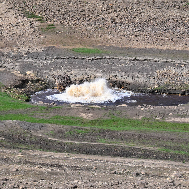
It sounds much more complicated than it really is. In simple terms, the new system gives engineers another large route for getting water from behind the dam to the downstream side. Once a syphon is primed, the difference in water level helps keep the water moving through it, allowing very large amounts to be released in a controlled way.
And this is not a small pipe being tucked into a corner of the dam.
Northumbrian Water's earlier design work gives a good idea of the scale. The concept for Hury included two syphon pipes, each around 220 metres long and 700 millimetres in diameter, along with larger gravity pipework, new valves, inlet and discharge chambers, a system to prime the syphons and a new power supply. The design also involved work through the dam crest and the use of piling and a cofferdam during construction.
Those figures come from the concept design, so the finished system may not match every early measurement exactly. They do show just how substantial the job is, and why lowering the reservoir is only one small part of what is happening at Hury.
Where did all the water go?
Standing beside Hury while it is this low, this is probably the question that comes next. There is a huge amount of water missing from the reservoir, so where did it all go?
Some of it was moved to other nearby reservoirs and some was released into the River Tees as part of the managed drawdown. This happened during the exceptionally dry summer of 2026, when river and reservoir levels across the region were already under pressure.
Hury does not work on its own. It is part of the wider Lune and Balder reservoir system. Hury, Blackton and Balderhead sit along the River Balder, while Selset and Grassholme lie on the neighbouring Lune system. The two groups are connected and operated together, helping supply Lartington Water Treatment Works as well as supporting river flows when required. A tunnel also connects Selset Reservoir with Hury, allowing the Lune and Balder systems to work together.
There is not a published breakdown showing exactly how many litres left Hury during the 2026 drawdown, how much went into each neighbouring reservoir or exactly how every transfer was made. What we do know is that the water was managed within the wider system, with some moved elsewhere and some released downstream rather than simply being wasted.
The dry summer can make the story a little confusing. Reservoir levels across the North East were below average during 2026, so the weather certainly played a part in the wider picture. Hury, however, had already been deliberately drawn down in April for the planned works. The Environment Agency was still recording that planned drawdown in August.
So Hury really did have two things happening at once. It had been deliberately lowered for engineering work, then an unusually dry summer arrived while the reservoir was already down.
What can you see now that Hury is so low?
For us, this is what makes the 2026 drawdown particularly interesting.
When Hury is full, you see the reservoir. When the water drops this far, you start seeing the valley underneath it.
The land does not stop at the normal shoreline. It continues down beneath the water, and with so much of Hury exposed you can suddenly follow slopes and channels that normally vanish below the surface. In places there is stonework, old looking lines across the ground and other features that are almost impossible to appreciate when the reservoir is full.
It also makes it much easier to picture what happened here when Hury was first created. The Victorians did not dig out a giant empty basin and fill it with water. They dammed the River Balder and flooded part of an existing landscape. The old valley floor is still down there.
That does not mean everything appearing from the water belongs to the landscape before the reservoir. Hury has been a working piece of water infrastructure for more than 130 years and plenty has been built, altered and repaired during that time. Some stonework may be connected with the reservoir itself, some may be older and some features may be nothing more mysterious than boundaries or drainage.
Our photographs are therefore going to do something quite simple. They will show what was there.
Where a feature can be identified properly, we can explain it. Where it cannot, the photograph still preserves exactly what could be seen below Hury's normal waterline during the 2026 drawdown. There is no need to turn every wall or line of stones into a lost building to make the photographs interesting.
Once the reservoir fills again, most of it will disappear from view.
Why does the work cost £15 million?
Looking at the low water from the bank, £15 million can sound an enormous amount for what might first appear to be a couple of new pipes and some work around the spillway.
The scale starts making more sense once you look at what has to happen around them. Engineers are working on a large Victorian earth dam that still forms part of an important water supply system. The reservoir has to remain managed throughout the job, heavy construction work has to take place around the dam itself and the new system needs to be able to move a very large volume of water safely.
Northumbrian Water's early design work also shows the amount of infrastructure involved. Alongside the two large syphon pipes were substantial underground pipework, concrete chambers, valves, power supplies, pumps, piling and temporary engineering needed to allow construction to take place. Maintaining the supply towards Lartington Water Treatment Works was one of the constraints built into that design.
The £15 million figure is the announced investment in the project while work is still under way, rather than a final bill after everything has been completed.
Even the mushrooms have affected the job
One of the more unexpected parts of the Hury project has nothing to do with water.
Surveys around the dam found more than 30 species of fungi, including waxcaps. The grassland here is significant enough for Northumbrian Water to describe Hury as internationally important for its fungi, which created a slightly unusual problem when planning where construction vehicles, machinery and compounds could go.
Rather than simply driving across it, the working area was reduced and sections of fungi rich grassland were moved away from the construction zone. Fencing has been used to keep vehicles off sensitive areas, while the layout of the work has also taken account of otters that use their normal routes around the spillway.
It is quite a contrast when you are standing there. This is a £15 million project involving a dam, huge pipes and heavy machinery, yet part of the planning has involved protecting small patches of grass and mushrooms growing beside it.
Visiting Hury Reservoir while the work is taking place
Hury is still worth seeing while the water is down. In fact, it is a completely different view of the reservoir, but visitors should expect things around the dam to look different while construction continues.
The dam crest is closed during the works and access around the site can change as the job moves on. Fishing is also suspended during the periods when the reservoir needs to be lowered for the project.
When we visited in September 2026, the north car park was closed but the south car park was still open. That is how we found Hury on our visit rather than a permanent access arrangement for the whole project, so it is worth following whatever signs and temporary closures are in place when you arrive.
The exposed reservoir floor is best enjoyed from the banks and paths. It can look dry and firm from a distance, but reservoir mud, changing water levels and working infrastructure make it very different from ordinary open ground. Northumbrian Water's Waterside Parks guidance is clear that visitors should not enter the reservoir water, and temporary restrictions around the site should always be followed.
There is plenty to see without walking onto the reservoir bed.
Hury has changed before, and it will change again
It is strange to think that the view which now looks so unusual would have been completely normal before the reservoir existed.
Before Hury became operational in 1892, the River Balder simply continued through the valley. The new dam flooded part of that landscape and turned it into the reservoir generations of people have grown used to seeing. The dam itself was an impressive Victorian engineering project, built as an earth embankment with a concrete cut off and puddle clay core.
We are keeping the full story of how Hury was planned and built for our separate history page because it deserves far more room than it needs here. What is lovely about the current work is that it connects those two periods. The reservoir that James Mansergh designed in the nineteenth century is still working today, only now it is being altered again to meet the safety standards and water needs of the twenty first century.
Why we wanted to photograph Hury like this
The machinery will eventually leave. The work around the dam will finish. Hury will fill and from most viewpoints it will once again look like the reservoir we know.
The exposed ground will disappear first.
That is why we took so many photographs while the level was down. This is not something we wanted to record with one distant picture of a low reservoir and then forget about. There is a whole landscape visible at the moment that normally sits beneath the water, and the 2026 works have given us a rare chance to photograph it.
In years to come, the £15 million project will simply become another part of Hury's history. People will search for why Hury Reservoir was drained, what was under the water, what work was carried out at Hury in 2026 or perhaps just wonder what the reservoir looked like while the new syphon was being built.
Hopefully these photographs, and this page alongside them, will still be here to show them.



Explore more around Hury and Teesdale
If this page has made you want to see more of Hury, have a look at our main Hury Reservoir guide, where we cover the reservoir itself, the surrounding landscape and what there is to see around Baldersdale.
There is a lot more history packed into this little part of the valley too. You can read about Hury Mill, which once stood beside the River Balder before the reservoir changed the landscape, and Hury Mill Bridge, one of the older surviving features still crossing the river below the dam. We also have our full History of Hury Reservoir page, which follows the story from the original planning and construction through to the reservoir becoming part of the water system we know today.
A little further around Hury, Yew Tree Farm has its own story, with traces of the older landscape still sitting around the reservoir. If you want to go wider, our Cow Green Reservoir hub takes you into another part of Teesdale's reservoir history and landscape.
For more places, walks, history, reservoirs and local guides across the dale, head back to Discover Teesdale. You can also open the Discover Teesdale web app to explore the map, find places nearby and see what else is around you while you are out.