Hury Mill, Baldersdale
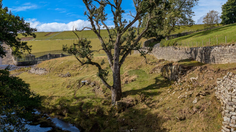
Just upstream from Hury Mill Bridge, on the north side of the River Balder, is a small patch of grass beside the road. There is very little there today to suggest that a working water mill once stood here, but Hury Mill was part of this corner of Baldersdale for well over a century before the reservoir changed everything.
What started as a search for a mill shown on an old map took us much further back than expected. Hury Mill was definitely here by 1741, when it was recorded as a water corn mill with its own kiln, and there may be an earlier reference from 1735. By around 1810 the name Hury Mill Farm was in use, with the mill and farmland forming part of a much bigger working landscape beside the Balder.
Quick Facts
Location: Hury, Baldersdale
Grid reference: NY 96800 19600
Type: Water-powered corn mill
Definitely recorded: 1741
Possible earlier record: 1735
Known features: Corn mill, kiln, house, mill race and farmland
Earliest person found at Hury Mill: George Lamb, 1765
Later known as: Hury Mill Farm
Lost: During the construction of Hury Reservoir in the 1880s
Still nearby: Hury Mill Bridge

Where was Hury Mill?
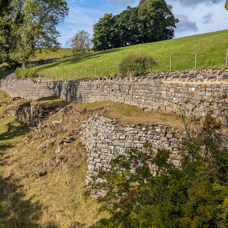
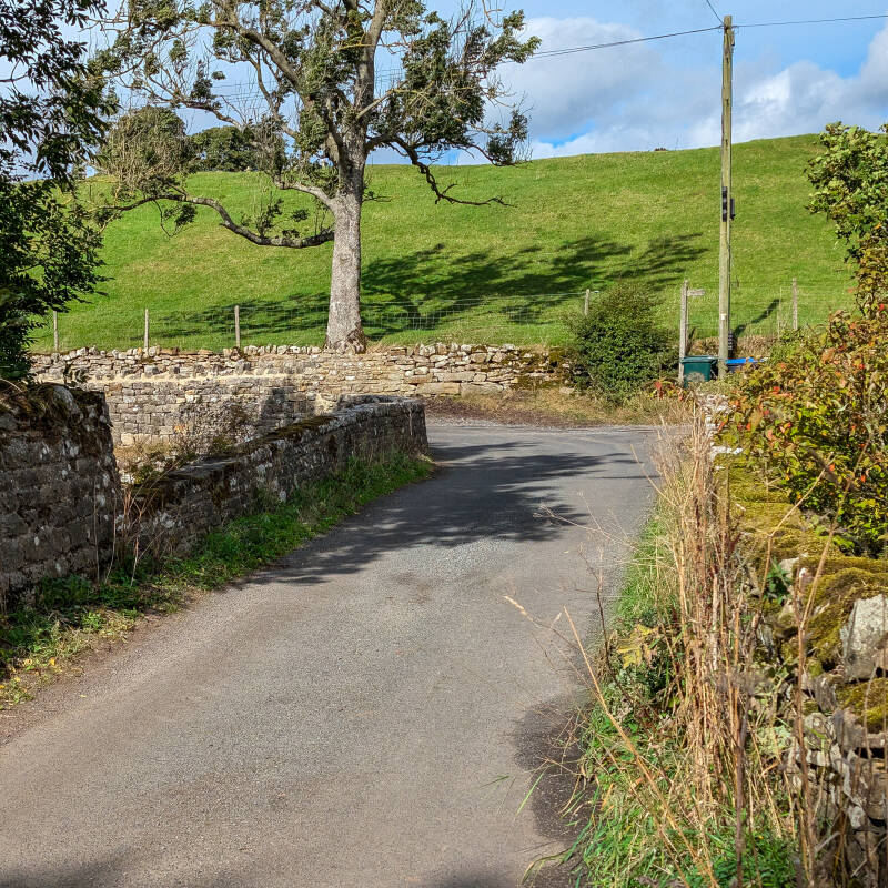
Hury Mill stood immediately upstream from Hury Mill Bridge on the north side of the River Balder. The recorded site is NY 96800 19600, in the small patch of grass beside the road close to the eastern end of Hury Reservoir.
It is surprisingly easy to pass without realising what was once here. Before the reservoir and dam, the mill buildings stood beside the Balder with a mill race bringing water towards them. The surrounding land later formed Hury Mill Farm.
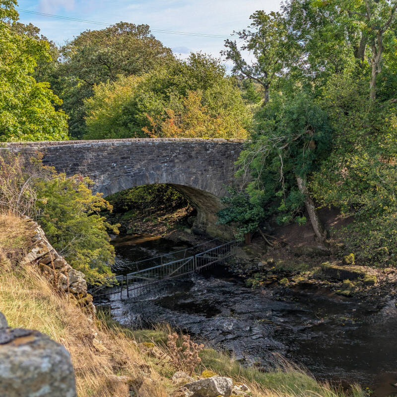
Hury Mill Bridge is one of the few obvious survivors from that older landscape. The present stone bridge dates from the mid to late 1700s, so for generations the bridge, mill and river were all part of this small corner of Baldersdale.
How far back does Hury Mill go?
The first date we can put Hury Mill on with certainty is 1741.
On 2 February that year, the Huddleston estates at Cotherstone and Hunderthwaite were being transferred to George Bowes of Streatlam Castle. The deed specifically included Hury Mill as a water corn mill with a kiln. That gives us much more than just a place name and proves that a corn mill was already established beside the River Balder by 1741.
There may be an earlier appearance. On 30 September 1735, property belonging to the same estate included a water corn mill in Baldersdale called Henry Mill, together with a house and land called Thorngate Hill. The location and description fit Hury remarkably well, but the surviving catalogue reads Henry rather than Hury, so we are keeping 1741 as the first definite date.
There are even earlier references to an unnamed mill within the manors of Thwaites, Hunderthwaite and Cotherstone in 1721 and again in 1734. It may have been Hury, but there is not enough information to tie either one to this exact site.
Hury Mill then appears again among a surviving bundle of estate building records dated between 1738 and 1808. The bundle contains estimates, tenders, lists of dimensions and repair papers for several estate properties, including Hury Mill. We have not seen the individual Hury papers themselves, so there may still be much more of its eighteenth-century story waiting in that bundle.
The people at Hury Mill
The earliest person we have found connected directly with Hury Mill is George Lamb. A later historical record places him there in 1765. We do not know whether Lamb was the miller, but he gives us our first name to put alongside Hury Mill rather than simply another estate record or place name.
By around 1810, the holding was being called Hury Mill Farm. A dedicated estate plan survives under the title Plan of Thorngarth Hill Farm and Hury Mill Farm, showing how firmly the mill had become part of the farming landscape around Hury.
The early Ordnance Survey maps fill in more of the picture. The buildings stood beside the river and a mill race can be followed towards them, showing how water was brought from the Balder to power the mill.
The nineteenth-century newspaper references add some of the human story. In 1859, a haystack belonging to George Wright was set alight in a field near Hury Mill. In 1876, 16-year-old John Gregson of London died while staying at his uncle's home at Hury Mill. By then this was not simply the name of a mill beside the river. People were living here and the mill had become part of a wider farm.
Years later, an old Hury miller was still remembered locally for selling his flour by the stone. It is only a small detail, but it takes us straight back to what Hury Mill was actually there to do and gives us a rare glimpse of the working mill rather than just the buildings shown on old maps.
The reservoir moves in
By the early 1880s, this old riverside landscape was about to change completely.
Land was being acquired for Hury Reservoir by 1882, and by 1883 the paperwork around Hury had become extensive. Farmhouses and outbuildings were being described, land was being surveyed, compensation was being calculated and four Hury farm tenancies were examined. Among those papers is one document with a particularly important title, Valuation of Hury Mill Farm.
Much of this work involved Ralph Dent and his Hury properties. The surviving records include descriptions of his farmhouses and outbuildings, surveys of his Hury farms and compensation for land being taken for the reservoir.
The contract for Hury Reservoir was let in 1884. Walter Scott & Co carried out the work, with James Mansergh as engineer, and by 1886 construction was well underway. Problems with the ground meant parts of the main trench had to be taken deeper than first expected.
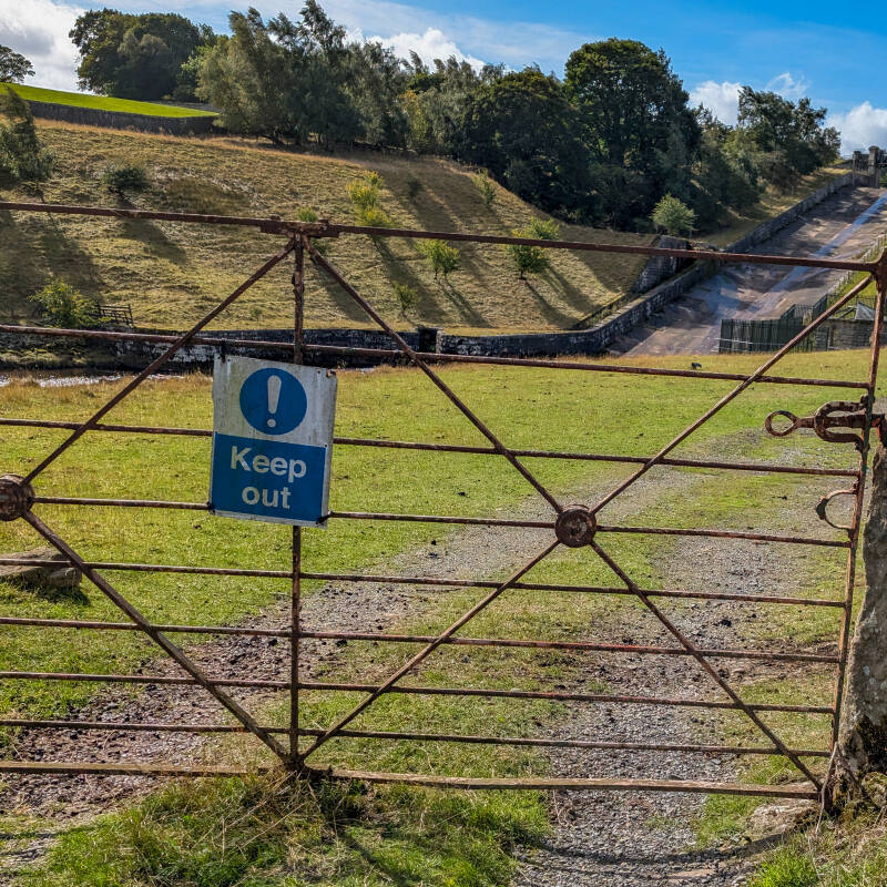
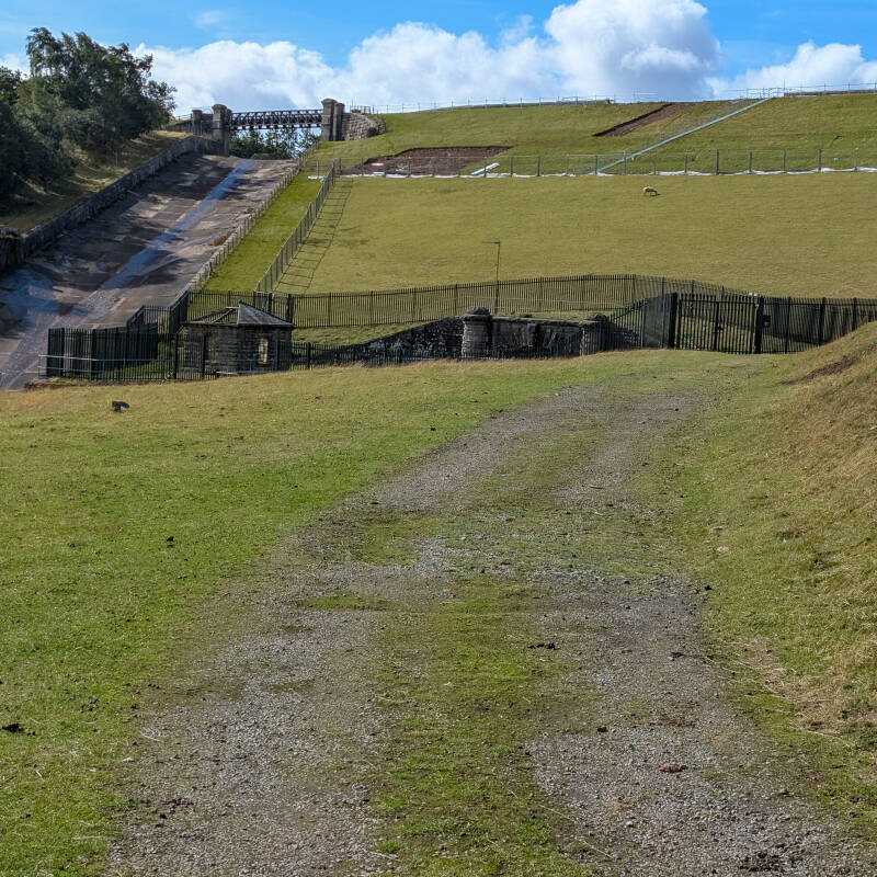
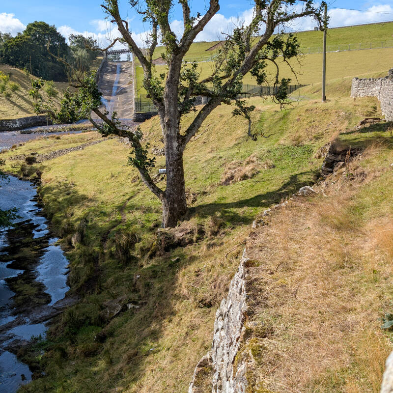
By 1887 to 1888 the new dam was being built across the Balder at Hury Mill. The quiet riverside landscape around the old mill had become one of the main construction areas for the new reservoir.
So when was Hury Mill demolished?
This is one date we still cannot pin down exactly.
Hury Mill Farm was separately valued around 1883 as the reservoir scheme moved forward. The contract for Hury Reservoir was let in 1884, and the Historic Environment Record records the corn mill as being destroyed when Hury Reservoir was built, giving a date of around 1884.
That is the closest we currently have to a demolition date, but it is not an actual record of the mill being pulled down. Hury Reservoir took several years to build and in 1887 to 1888 the new dam was still being constructed across the Balder at Hury Mill.
By 1890 the local directory lists millers at Cotherstone Mill and Doe Park Mill, but nobody is listed as a miller at Hury. That does not tell us exactly when Hury Mill stopped working, but it does show that Hury was no longer being recorded as an active milling business by then.
For now, the safest conclusion is that Hury Mill disappeared during the reservoir works of the 1880s. Historic England gives around 1884, but until an actual demolition record turns up, we are leaving the exact year open.
What survived?
Later mapping uses the name Old Mill House close to the former mill site. Exactly what survived there is still unclear. It may have been the mill house, another part of the old mill complex or a building that simply kept the old name.
Hury Mill Bridge survived and still crosses the Balder immediately below the mill site. The present bridge dates from the mid to late 1700s and gives us one of the clearest surviving links with the landscape that existed here before the reservoir.
The one thing we would still love to find is a photograph of Hury Mill itself. Photographs of the reservoir works survive, but so far we have not found one that we can confidently identify as the old mill.
Visiting Hury Mill today
Hury Mill Bridge is the easiest landmark. From the bridge, look just upstream on the north side of the River Balder towards the small patch of grass beside the road. The recorded mill site is around NY 96800 19600.
There is no large ruin and nothing that immediately tells you a corn mill once stood there. Without knowing the history, it would be very easy to pass without giving this little patch beside the Balder a second thought.
Once you start putting everything back together, it becomes a completely different place. By 1741 there was already a water corn mill with a kiln here. George Lamb was at Hury Mill in 1765. By around 1810 the name Hury Mill Farm was in use, and later maps show the buildings beside the river with the mill race running towards them.
Then the reservoir works arrived in the 1880s and this little corner of Baldersdale changed completely. The mill disappeared, the dam rose beside it and what had been a working mill and farm became part of the reservoir landscape.
Standing there today, the strange thing is how little there is left to show any of it. Without the old maps, newspaper references and estate records, it would be very easy to cross Hury Mill Bridge without ever realising what once stood just upstream. We still want to find a photograph of the mill itself, but for now that small patch beside the Balder is where more than 140 years of Hury Mill's known story comes to an end.
Explore more around Hury
Hury Mill was only one part of the old landscape here. For the wider picture, start with our Hury Reservoir guide, then read the full history of Hury Reservoir to see how Baldersdale changed as the waterworks were planned and built. Just downstream, Hury Mill Bridge is one of the best surviving pieces of that older landscape and is still carrying the road across the River Balder more than 200 years later.
You can also explore the remains of Yew Tree Farm, discover the prehistoric Hury and Blackton Reservoir rock art, and read about the Hury Reservoir drawdown and current improvement works taking place around the reservoir today.
You can also explore more stories from across the dale in our Teesdale History & Heritage section.
Or head to Discover Teesdale for more places across the dale, and open the Discover Teesdale map and web app to find walks, history, places to eat, accommodation and things to do nearby.