Holy Island Circular Walk: Castle, Coast, Priory and Crooked Lonnen
There are plenty of ways to explore Holy Island on foot, but if you are visiting for the first time and want one fairly short circular walk that joins together many of the places you have come to see, this is the route we would choose.
Our Holy Island walk starts at the main Chare Ends visitor car park and heads into the village before leaving the buildings behind along Crooked Lonnen. From there you cross the open eastern side of Lindisfarne, turn towards the coast and follow the island down to the huge Castle Point lime kilns and Lindisfarne Castle. The return takes you back towards the harbour, over the Heugh and up to the Holy Island Lookout Tower before dropping down beside Lindisfarne Priory and returning through the village.
At around 3.15 miles, it isn't a long walk, but that is part of what makes it so good. Holy Island is somewhere we would rather spend time exploring than simply chasing miles. On this route you can wander through the village, explore the lime kilns, stop at the castle, climb the Lookout Tower and still have plenty of time to enjoy the smaller places along the way.
The walking itself should take around an hour and a half at a comfortable pace, but we would allow several hours. Once you start stopping to look around, this little three-mile circular can quite easily become a large part of your day.
* marks affiliate links. If you buy or sign up, we earn commission at no extra cost to you.
It helps cover website costs and keeps our guides free.
Quick Facts
Distance: 3.15 miles / 5.1 km
Route: Circular
Difficulty: Easy, with one short rough descent
Allow: 3–4 hours with stops
Start: Chare Ends Car Park, TD15 2SE
Parking: Pay and display
Toilets: Green Lane, TD15 2SQ
Terrain: Roads, tracks, grass and uneven ground
Highlights: Lindisfarne Castle, Lime Kilns, Lookout Tower & Priory
OS Map: Explorer 340 – Holy Island & Bamburgh*
Digital route: See the route*
GPX: Free download

Holy Island Circular Walk Map
Our route is shown on the map below. It starts and finishes at Chare Ends Car Park and follows a clockwise loop around the eastern side of Holy Island.
From the village the route heads out across Crooked Lonnen before turning south along the eastern side of the island. This brings you to Castle Point and the lime kilns first, followed by Lindisfarne Castle. You then begin the return towards the village, taking in the harbour and Heugh before climbing to the Lookout Tower and dropping down beside the Priory.
If you are following the route on your phone, we would still download or save the map before setting off. Holy Island is not difficult countryside to navigate, but several paths and tracks cross the open fields around the village and castle and having the route in front of you removes any guesswork.
Before You Set Off, Check the Holy Island Tide Times
The most important part of planning any Holy Island walk happens before you even arrive.
Holy Island is connected to the Northumberland mainland by a tidal road causeway. At high tide the road is covered by the sea and cannot be crossed, so every visit has to be planned around the official safe crossing times.
Always check the current Holy Island safe crossing times before travelling and leave yourself a generous margin at the end of the visit. Northumberland County Council advises allowing an additional 30 minutes because local conditions such as strong winds can alter the predicted times.
We would never look at this as a 3.15-mile walk and assume that two hours on the island is enough. You still need time to park, walk into the village, explore anything that interests you, get back to the car and then drive safely across the causeway before the crossing period ends.
The famous Pilgrim's Way across the sands is a completely separate route. The published road causeway times do not apply to walking across the sands, so don't use this walk or the road crossing timetable to plan a Pilgrim's Way crossing.
For everything else you need before travelling, including the causeway, parking and planning your day, see our complete Holy Island Visitor Guide.
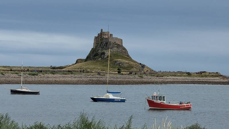
Where to Park for the Holy Island Walk
We start this circular at Chare Ends Car Park, Holy Island, TD15 2SE.
It is the large main visitor car park you reach shortly after driving onto the island and is the straightforward place to park for a day visit. From the car park it is only a short walk into the village and our route eventually brings you back to the same place.
Chare Ends is a paid car park. Prices can change, so we would check the current Northumberland County Council information or the signs when you arrive.
One useful thing to know before starting is that the public toilets are not in the main Chare Ends visitor car park. They are further into the village at Green Lane Car Park, which this route passes near the beginning.
From Chare Ends Car Park Into Holy Island Village
Leave the car park and follow Chare Ends towards the village.
It isn't far, but this first stretch is worth taking slowly because there are sometimes a few small market-style stalls on the left-hand side as you walk towards the houses. On different visits we have seen fresh fruit and vegetables and cakes being sold here.
We wouldn't rely on them being open. They haven't been trading every time we have visited, and we haven't found fixed opening times that we would be happy telling people to plan around. If they are there, brilliant. If not, there are still cafés, pubs and other places for food and drink once you reach the village.
That small detail is actually one of the reasons we like beginning the walk this way. You get a little taste of the village before heading away from most of the busy visitor areas and out into the open side of the island.
Public Toilets at Green Lane
As you make your way through the village and towards the lane leading out onto the open part of the walk, this is a good time to use the public toilets.
The Public Toilets at Green Lane Car Park, TD15 2SQ are currently the island's public toilet facilities. They include accessible facilities and are particularly useful if you are walking with children because once we leave this part of the village there are no public toilets on the long open section towards the castle.
Green Lane itself is not the normal visitor car park. Parking there is primarily provided for Blue Badge holders, with separate coach provision, so ordinary visitors should still use Chare Ends and walk into the village as we have done.
From here continue along the lane and leave the houses behind.
Leaving the Village for Crooked Lonnen
This is where the character of the walk changes properly.
Within a surprisingly short distance, the village begins disappearing behind you and Holy Island opens into fields and wide views. It feels very different from the busier streets around the shops, Priory and castle.
Follow the lane out from the village towards the track crossing the island. Older maps label this route Crooked Loaning, while today you will commonly see it referred to as Crooked Lonnen.
Once you join it, turn east and follow it across the island.
Despite the name, much of this section feels remarkably straight. The track cuts across the fields with very little around you and is one of the reasons we wanted to use this route rather than simply walking directly from the village to the castle and back again.
You haven't travelled far at all, but this is already a much quieter side of Lindisfarne.
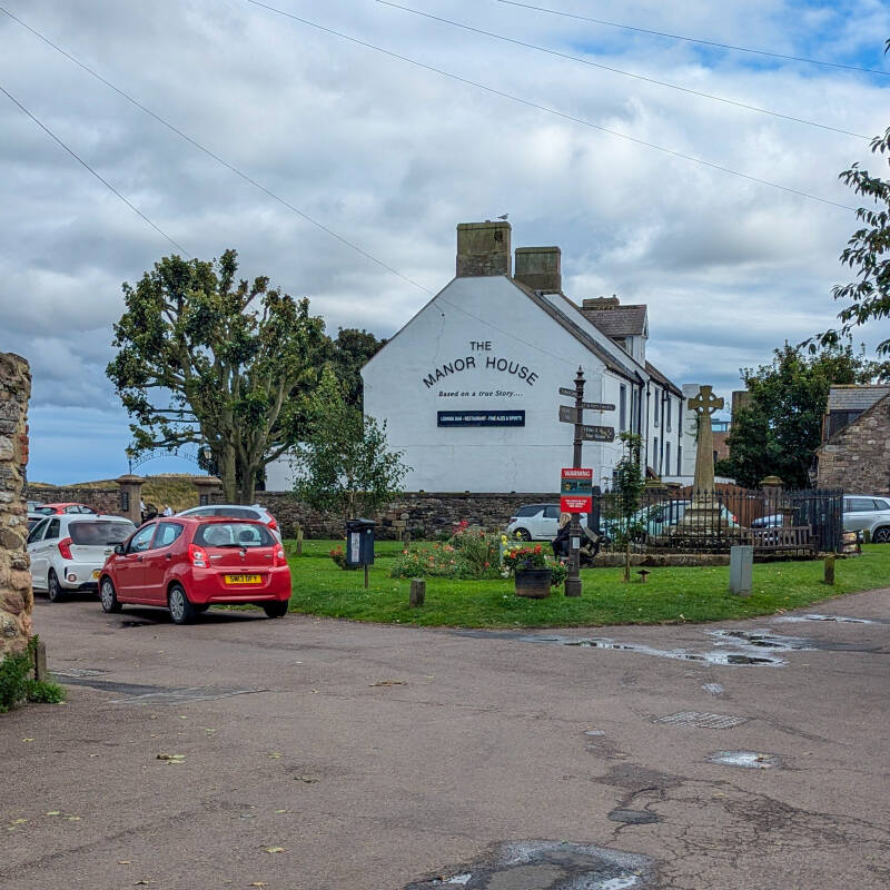
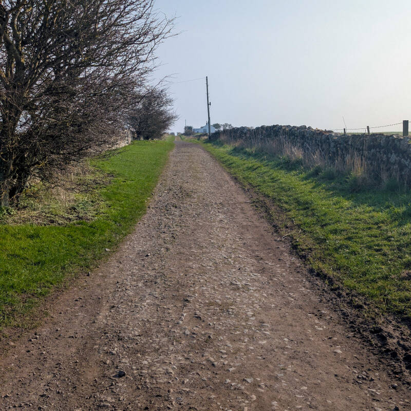
Walking Crooked Lonnen Across Holy Island
Continue along Crooked Lonnen as it carries you east across the open fields.
There aren't any major attractions on this section and that is exactly what we like about it. After the village, the walk becomes about the island itself for a while rather than individual buildings or things to tick off a list.
On a clear day you have huge skies above you and long views across the surrounding countryside. Depending on the season, livestock may be present in the fields, so keep dogs under proper control and follow any temporary notices or instructions you find along the route.
Eventually Crooked Lonnen reaches the eastern side of Holy Island. Here our route turns right and begins heading south towards Castle Point.
This is the point where the walk starts to feel properly circular. Instead of returning towards the village, you are now following the outer side of the island with the coast close by and Lindisfarne Castle waiting further ahead.
Down the Eastern Side of Holy Island
Follow the path south with the open coast to your left and fields to your right.
This is another lovely quiet stretch and a complete contrast to the area around Marygate and the Priory. Even on a busy day it doesn't take much distance to find a bit more space on Holy Island.
The ground is mostly straightforward, although conditions on exposed coastal paths can obviously change after prolonged wet weather. There is no reason to rush here. The route is short enough to take your time and enjoy the views before reaching the busier castle area.
As you approach Castle Point, the shape of the land begins to pull you back around towards Lindisfarne Castle.
And following our walk in this direction means the first big historic stop you reach is not the castle.
It is underneath it.
Castle Point Lime Kilns
The enormous Castle Point lime kilns are one of our favourite places on Holy Island and make a brilliant first stop after the long open section of the walk.
From a distance the castle tends to grab all the attention, but once you get close to the kilns it is difficult not to be impressed by their size. These substantial 19th-century structures are a reminder that Lindisfarne also had an industrial story.
Limestone quarried elsewhere on the island was transported towards Castle Point along a wagonway and burned with coal in the kilns to produce quicklime. You can still walk around the surviving structure and look into the large openings at its base.
Because we approach Castle Point from the east, the kilns naturally come before Lindisfarne Castle on our route. Take your time here rather than treating them as something to hurry past on the way to the more famous building above.
We have explored their history, how they worked and what remains today in our full Holy Island Lime Kilns guide.
From the Lime Kilns to Lindisfarne Castle
Continue west from the kilns towards Lindisfarne Castle.
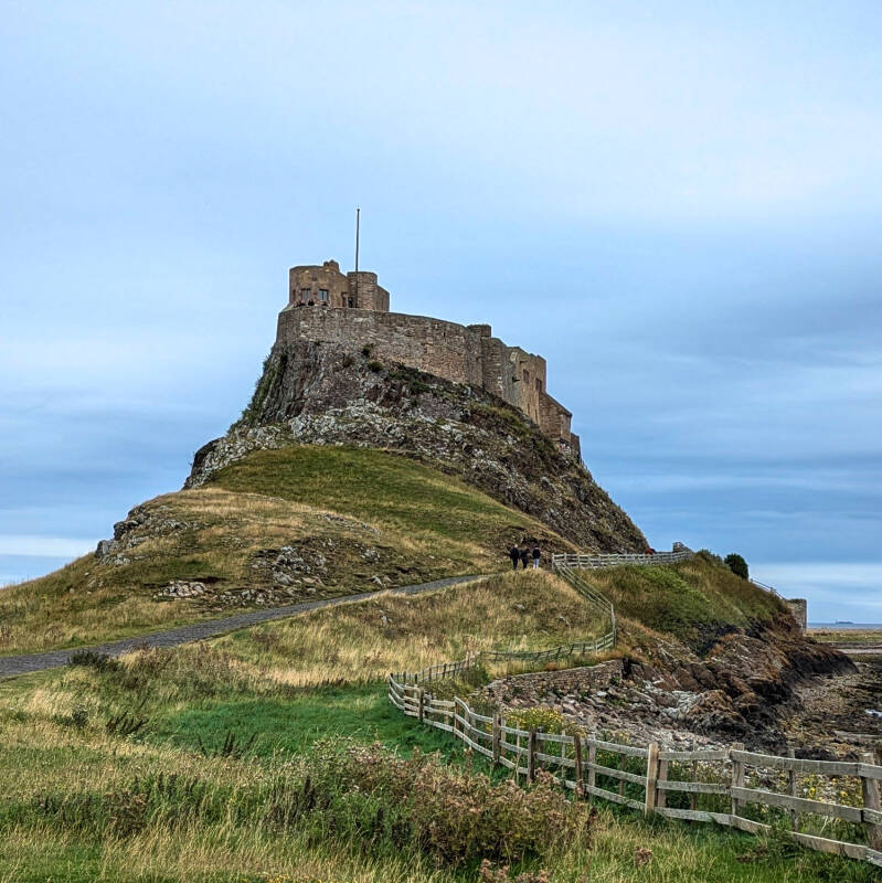
The castle stands on Beblowe Crag and is the landmark that dominates this end of the island. What you see today started life as a fortification before being transformed in the early 20th century by architect Edwin Lutyens into a private holiday home for Edward Hudson, founder of Country Life.
You do not have to pay simply to walk around the castle grounds and surrounding headland. Admission applies if you want to enter Lindisfarne Castle itself.
If you are visiting inside, this is another reason to give the walk far more time than the distance suggests. You can easily stop here for quite a while before continuing the circular.
Close to the castle is the small walled garden designed by Gertrude Jekyll in 1911. It is a short addition if you want to look around before returning to the main route.
For opening information, what there is to see and more of the story behind the building, see our Lindisfarne Castle guide.
The Harbour and Upturned Boat Sheds
Leave the castle area and begin heading back towards the village and harbour.
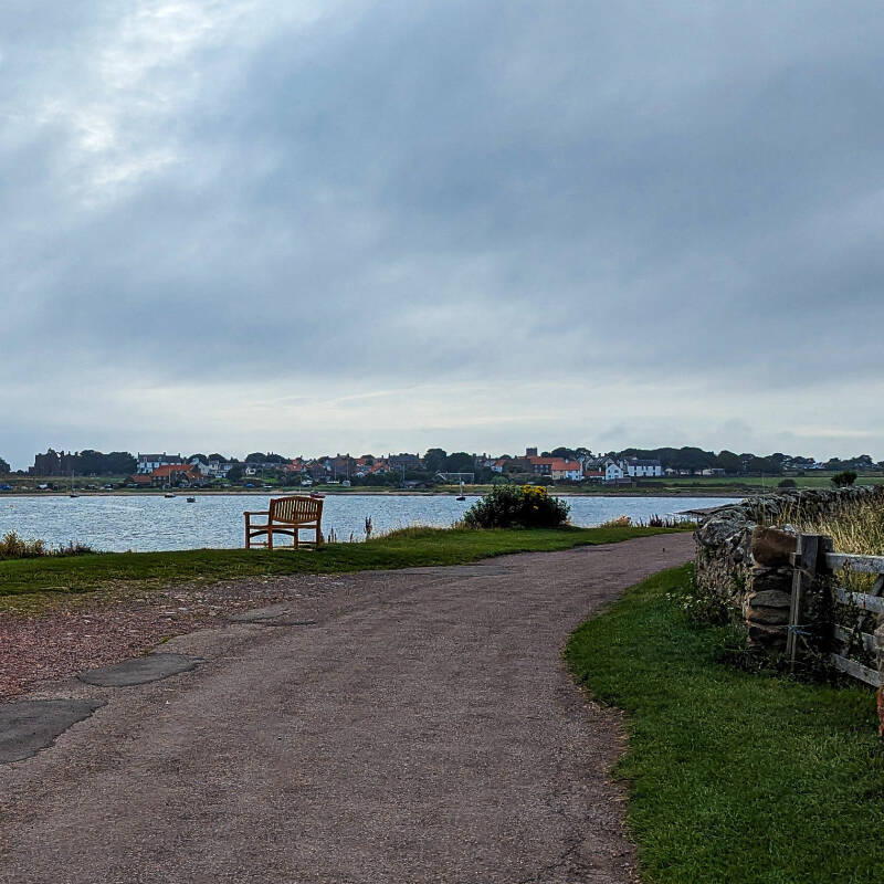
After the wide open eastern side of the island, things gradually begin to feel busier again. The Ouse, Holy Island's natural harbour, comes back into view and there are lovely views across the water towards the village and the Heugh.
Around the harbour you can also spot some of Holy Island's distinctive upturned boat sheds. Old boats were turned upside down and reused as storage buildings, creating one of the smaller sights that has become closely associated with Lindisfarne.
They are easy to glance at and carry on walking, but there is a much more interesting story behind them, which we cover separately in our Holy Island Upturned Boat Sheds guide.
The walk now begins turning towards the Heugh, the low rocky ridge on the southern side of the village.
Window on Wild Lindisfarne
As you return from the castle, Window on Wild Lindisfarne is close to the route and is worth a look if the building is open.
It was created as a place where visitors can look out across the surrounding habitat and learn a little more about the wildlife of Lindisfarne. Inside are information displays and a large viewing window overlooking the field.
This part of Holy Island sits within an internationally important coastal environment, so the building helps explain that there is far more around you than simply empty mudflats and fields.
It is another small stop that doesn't need to take long but adds something different to the walk.
Holy Island Lookout Tower
The Holy Island Lookout Tower is one of our favourite little stops on this walk.
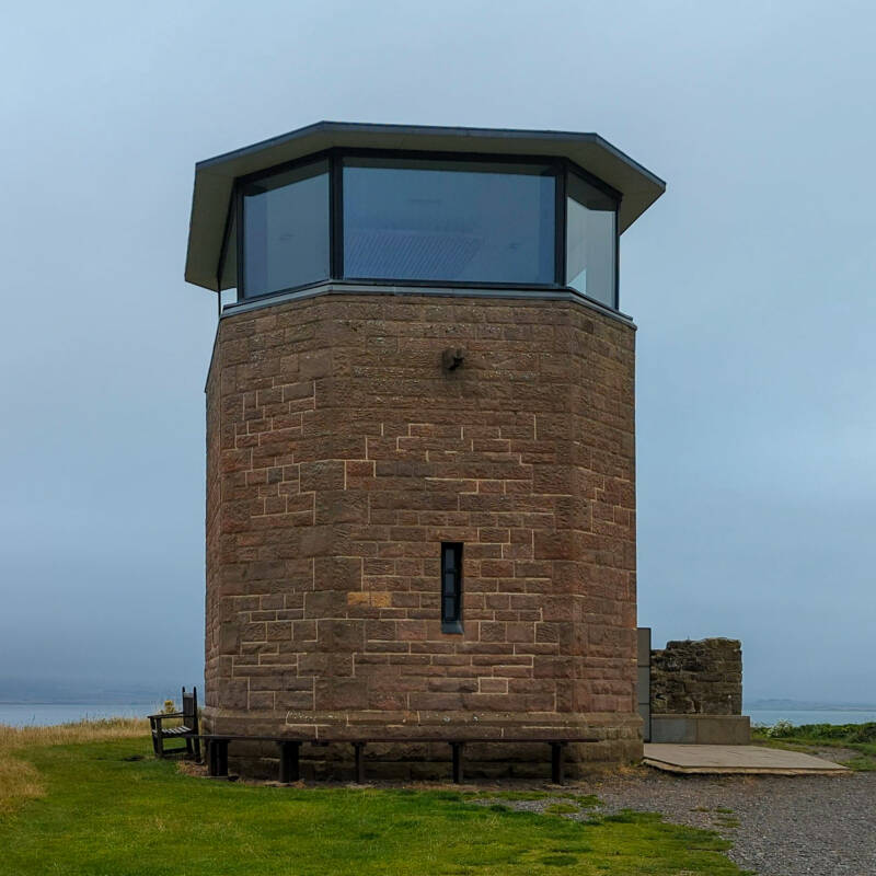
The former coastguard lookout has been turned into a small observation point where you can go inside when it is open and look out across Holy Island. It isn't a huge building and you won't spend hours inside, but its position makes it well worth the short climb.
From up here you begin to appreciate how everything fits together. Lindisfarne Castle sits away to the east, the harbour lies below, the Priory is close by and on a clear day the views stretch well beyond the island itself.
It is also a nice contrast to the major paid attractions. This is a small community heritage building rather than somewhere that requires a long planned visit.
We have a complete Holy Island Lookout Tower guide covering what it is, the views and what to expect when you visit.
The short scrambly section below the Lookout
There is one little section of this walk that we think is worth warning people about.
Coming down from the Lookout on our route there is a short rough and slightly scrambly descent. It isn't a long section and we wouldn't class the overall walk as difficult because of it, but you do need to watch where you put your feet.
The ground is uneven and would obviously deserve more care when wet. With younger children we would take our time here and give them a hand if needed.
This is also one of the main reasons we wouldn't describe our complete Holy Island circular as pushchair-friendly, even though many of the roads and lanes elsewhere on the route are easy.
Down Towards Lindisfarne Priory
After coming down from the Heugh, the walk reaches one of the most historic parts of Holy Island.
The remains of Lindisfarne Priory sit beside the village, with St Mary's Church close by. The ruins visible today are principally those of the medieval priory established on the site of the earlier Anglo-Saxon monastery.
The story here begins much earlier. In AD 635 King Oswald gave Lindisfarne to Aidan and his companions, who established a monastery on the island. Lindisfarne went on to become one of the great centres of early Christianity in Anglo-Saxon England.
You don't need to enter the English Heritage attraction to complete our walk, but if you have enough time within your safe crossing window it is one of the major places worth exploring properly.
The Holy Island Lifeboat House
Close to the Priory and shore is another much smaller building, the Old Lifeboat House.
It is easy to miss among the much bigger historic attractions around this part of Lindisfarne, but we think it is well worth including. The building tells the story of the island's lifeboat service and the people who went to sea from here.
It has been restored and is now one of the small community heritage attractions on the island. Entry is currently free, but we wouldn't plan the entire day around guaranteed fixed opening hours. If the door is open when you pass, go in and have a look.
Our Holy Island Lifeboat House guide goes into the story and what you can see inside.
Back Through Holy Island Village
From the Priory area, head back into the village.
By now you have seen almost every side of this little circular. You started among the visitors arriving from the car park, escaped across Crooked Lonnen and the quiet eastern fields, came back past the lime kilns and castle, followed the harbour and then looked down over everything from the Heugh.
The final section gives you chance to slow down again in the village. If the tide gives you enough time, this is where we would stop for a drink, something to eat or simply have another wander before returning to the car.
Follow Chare Ends north from the village and continue back towards the large visitor car park where the walk began.
How Long Does the Holy Island Circular Walk Take?
Our route is 3.15 miles, and we would allow around 1½ hours of actual walking time at a relaxed pace.
In reality, we would give it much longer.
If you explore the lime kilns, stop at Lindisfarne Castle, climb the Lookout, look around the Priory area and pop into the smaller community attractions, three or four hours can disappear very easily.
If you also go inside Lindisfarne Castle or Lindisfarne Priory and stop for food, you could comfortably turn the route into most of your visit.
That is why the tide window matters far more here than the mileage.
Where Do You Park for a Holy Island Walk?
For this circular, park at Chare Ends Car Park, Holy Island, TD15 2SE.
It is the main visitor car park and the route begins and finishes there. The public toilets are further into the village at Green Lane Car Park, TD15 2SQ.
If somebody is looking for parking because they intend to walk the Pilgrim's Way from the mainland, that is a different route and they should use information specifically for the sands crossing rather than this circular walk.
Can You Take a Dog on the Holy Island Walk?
Yes, but Holy Island is an important place for wildlife and dogs need to be managed carefully.
Much of the island forms part of the Lindisfarne National Nature Reserve. Within the reserve, dogs should be kept on a lead or at heel and prevented from disturbing wildlife or livestock. Always follow any signs, seasonal restrictions or instructions you find along the route.
Dogs on leads are welcome at Lindisfarne Priory. Around Lindisfarne Castle, dogs should be kept on short leads in the grounds, particularly where livestock is grazing. Only assistance dogs are allowed inside the castle itself.
During bird breeding and migration periods, wildlife can be particularly vulnerable, so give birds plenty of space and stick to established paths.
Is the Holy Island Walk Free?
Yes. The route itself is free to walk.
There is also no charge simply to access Holy Island, but there are separate costs for parking and for entering some of the major attractions.
You can still see the village, Crooked Lonnen, coast, harbour and much of the castle surroundings without buying an attraction ticket, making this a very good walk even if you are trying to keep the cost of your day down.
Our Thoughts on This Holy Island Walk
What we like most about this route is that it doesn't feel like a three-mile walk.
You start among the cars and visitors arriving at Chare Ends, wander through the village and then almost immediately leave much of that behind. Crooked Lonnen takes you out across the fields and the eastern side of Lindisfarne feels completely different from the busy streets you left only a few minutes earlier.
Then the walk slowly brings the landmarks back.
First come the huge lime kilns at Castle Point, then Lindisfarne Castle above you. The harbour takes you towards the Heugh, the Lookout gives you a chance to see the island from above and finally you drop back down among more than a thousand years of history around the Priory.
It joins many of our favourite parts of Holy Island without trying to cram the entire island into one walk.
And because it is only just over three miles, there is no reason to rush it.
On Holy Island, that is probably the best way to explore.
Explore More of Holy Island
Our circular walk is a brilliant way to join several parts of Holy Island together, but many of the places along the way deserve a closer look. Use our complete Holy Island visitor guide for the wider island, then explore Lindisfarne Castle, the Holy Island Lime Kilns, Holy Island Lookout Tower and the Old Lifeboat House in more detail. You can also discover the island's past with our Holy Island history timeline, find locations on the interactive Holy Island map, or check the live Holy Island webcams before you set off.